April 10-16, 2018
Midwest Weekly Highlights - April 10-16, 2018
Record Cold Continues
Temperatures well below normal were common across the Midwest once again (Figure 1). Temperatures were more than 10°F below normal across Minnesota and northern Wisconsin, while most of Iowa and Michigan were 6-9°F below normal. Maximum temperatures were a major factor (Figure 2), as most of Wisconsin, Minnesota, northern Iowa and the U.P. of Michigan were 15°F or more below normal. These cold maximum temperatures led to nearly 600 daily low maximum temperature records alone (Figure 3). Many of these records occurred through the mornings of April 15 (Figure 4) and April 16 (Figure 5), where maximum temperatures were below freezing across parts of Minnesota, northern Wisconsin and northern Michigan.
A period of warmer temperatures mitigated some of the colder temperatures across the southern half of the Midwest in the middle of the period. Maximum temperatures reached the upper-70s and 80s across the southern half of the region through the mornings of April 13 (Figure 6) and April 14
(Figure 7). As a result, eastern Ohio was 1-4°F above normal for the period. More than 50 daily high temperature records were set as well, including more than two dozen in Ohio (Figure 8).
Wet for Many
Moderate to heavy precipitation fell across a large part of the Midwest during the period
(Figure 9). More than an inch of precipitation fell across southeastern Missouri, Kentucky, Ohio, Indiana Wisconsin, Michigan, southern Minnesota, northern Iowa and most of Illinois. Heavier amounts over two inches fell in eastern Ohio, Lower Michigan and central Wisconsin. Large amounts of precipitation fell through the mornings of April 14 (Figure 10) and April 16
(Figure 11) as a powerful winter storm stalled over the Midwest. Portions of Wisocnsin and northern Lower Michigan had three to five times the normal amount for the period (Figure 12). More than 150 daily precipitation records were broken across the region
(Figure 13). Colder temperatures led to measurable snowfall across the northern half of the region (Figure 14) and led to more than 300 daily snowfall records
(Figure 15). Most of this snowfall occurred during a powerful winter storm.
April 13-16 Winter Storm and Blizzard
Well below-normal temperatures, combined with a strong and slow-moving storm system led to a historic April snowstorm across Minnesota and Wisconsin on April 13-16 (Figure 16). More than a foot of snow fell on parts of norhteastern Wisconsin and northern Lower Mighigan on April 13 through the morning of April 14 (Figure 17). Southern Minnesota was then hit hardest on April 14 through the morning of April 15 (Figure 18). Eastern Minnesota, Wisconsin and the U.P. of Michigan were then hit once again through the morning of April 16 (Figure 19). Many stations in Minnesota recorded more than a foot of snowfall (Figure 20), while many in northern Wisconsin recorded more than two feet (Figure 21). Several of the highest snow totals included 30.0 inches near Sturgeon Bay, WI (Door County), 29.8 inches near Shawano, WI (Shawano County) and 28.4 inches in Waupaca, WI (Waupaca County). A blizzard warning was issued across southwestern Minnesota, northwestern Iowa and several counties in Wisconsin on April 14-15. This was 35 years to the date of a blizzard that dumped more than a foot of snow in eastern Minnesota and northwestern Wisconsin in 1983 (Figure 22). After the storm ended, it was estimated that more than 20 percent of Minnesota was covered in a foot or more of snow.
Impacts from the storm were felt across the Midwest. The cold and inclement weather postponed ten Major League Baseball games in Midwest cities from April 13-16. Three consecutive games between the Minnesota Twins and Chicago White Sox were postponed in Minneapolis, while multiple postponements occurred in Chicago, Cleveland and Detroit. Several roofs to buildings in Ashwaubenon, WI (Brown County) collapsed, where wet, heavy snowfall likely contributed. The Minneapolis-St. Paul Airport halted operations on April 14 and canceled almost all flights. Most highways in southwestern Minnesota were closed to due blizzard conditions, while hundreds of car crashes were reported. A driver was killed near Minneapolis on April 15 after being struck by a bus. More than a dozen more crashes involving injuries were reported.
April 13 Severe Weather
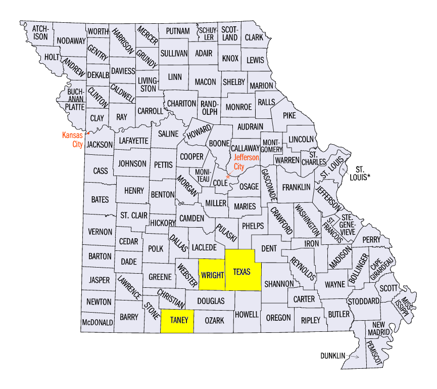
As the major winter storm gathered strength, strong to severe thunderstorms formed across southern Minnesota, Iowa, Wisconsin and Missouri on April 13 (Figure 23). In total, 96 tornado, wind and hail reports were reported across the region. Several EF-1 tornadoes were reported in southern Missouri, including near Dawson (Wright County) and near Success (Texas County). Large hail was also common across Minnesota, Iowa and Wisconsin. A two-inch hail stone fell near Henderson, IA (Montgomery County), while a 2.5 inch hail stone was reported near Powersite, MO (Taney County). A 70 mph wind gust was also reported near Powersite, MO, while trees, outbuildings and mobile homes were damaged in Missouri and Iowa from strong winds.
-BJP-