April 1-9, 2018
Midwest Weekly Highlights - April 1-9, 2018
Exceptional Cold
The first nine days of April were exceptionally cold across the Midwest (Figure 1). Every state except Kentucky had temperatures 8°F or more below normal, while Iowa, Minnesota northwestern Wisconsin and northern Missouri were more than 15°F below normal. Several areas in northern Missouri and Minnesota were more than 20°F below normal for the period. In some areas, this was the coldest April 1-9 on record based on average temperature. Some of these areas included the Minneapolis-St. Paul, MN Area, the St. Cloud, MN Area, and the Eau Claire, WI Area.
More than 1,400 daily low maximum and minimum temperature records were broken across the Midwest (Figure 2). Iowa recorded more than 360 daily records alone, while Missouri recorded more than 300. Wisconsin and Minnesota each recorded more than 200 daily records, while Illinois recorded more than 175 records. April 6 was the only day in the period that did not have more than 50 daily records. Several of the most record-breaking days included April 2
(Figure 3), April 7 (Figure 4) and April 8
(Figure 5). Minimum temperatures were below freezing across the entire Midwest on April 8 (Figure 6), which led to nearly 200 daily low minimum temperature records across the region.
Dry, except in the Ohio River Valley
Most of the Midwest received less than an inch of precipitation during the period
(Figure 7). Most of Minnesota, Iowa, southern Wisconsin, northern Illinois and Missouri had less than half the normal amount of precipitation (Figure 8). Meanwhile, the Ohio River Valley was wetter than normal from multiple days of heavy rain from April 2-4
(Figure 9). Amounts of up to 3 inches fell, with locally heavier amounts. Some of the heaviest amounts for that three-day period included 7.11 inches near the Indianapolis Eagle Creek (Marion County), 4.90 inches in Rockville, IN (Parke County) and 4.05 inches near the Indianapolis Weather Service Office (Marion County).
Widespread Snowfall
Freezing temperatures led to measurable snowfall across most of the Midwest, except isolated areas in southern Missouri, southern Illinois, and southern Kentucky (Figure 10). Most of southern Minnesota, northern Wisconsin, and northern parts of Michigan had more than five inches of snow during the period. Areas around northern Lake Michigan had more than a foot of snowfall. Snow fell somewhere in the Midwest region on each day of the period. Areas in northern Missouri, central Illinois and central Indiana had 2-5 inches of snowfall from a storm on April 1 through the morning of April 2
(Figure 11). More than 8 inches of snow fell across northern Wisconsin and northern Lower Michigan through the morning of April 4 (Figure 12). Another strong snow event brought 6-10 inches of snow to southwestern Minnesota and northern Iowa through the morning of April 9 (Figure 13). More than 400 daily snowfall records were broken during the period (Figure 14). In many cases, the snowfall during this period was more than the long term average for the month of April
(Figure 15).
April 3 Tornadoes and Severe Weather
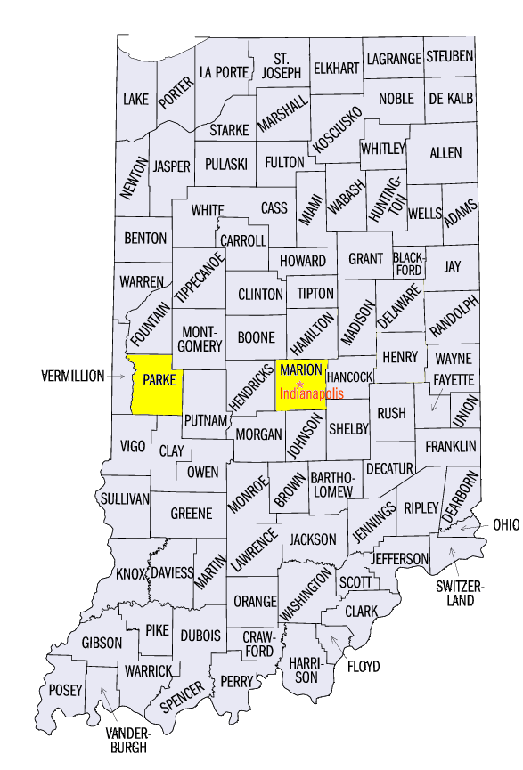
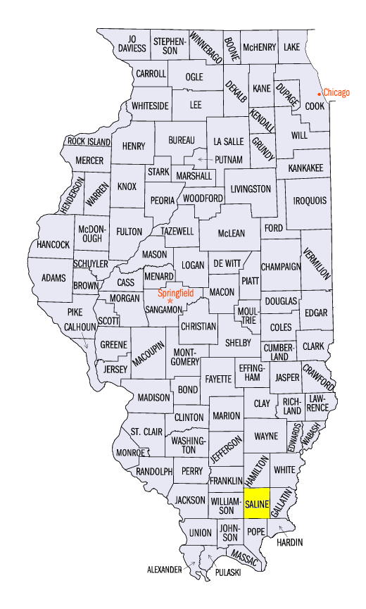
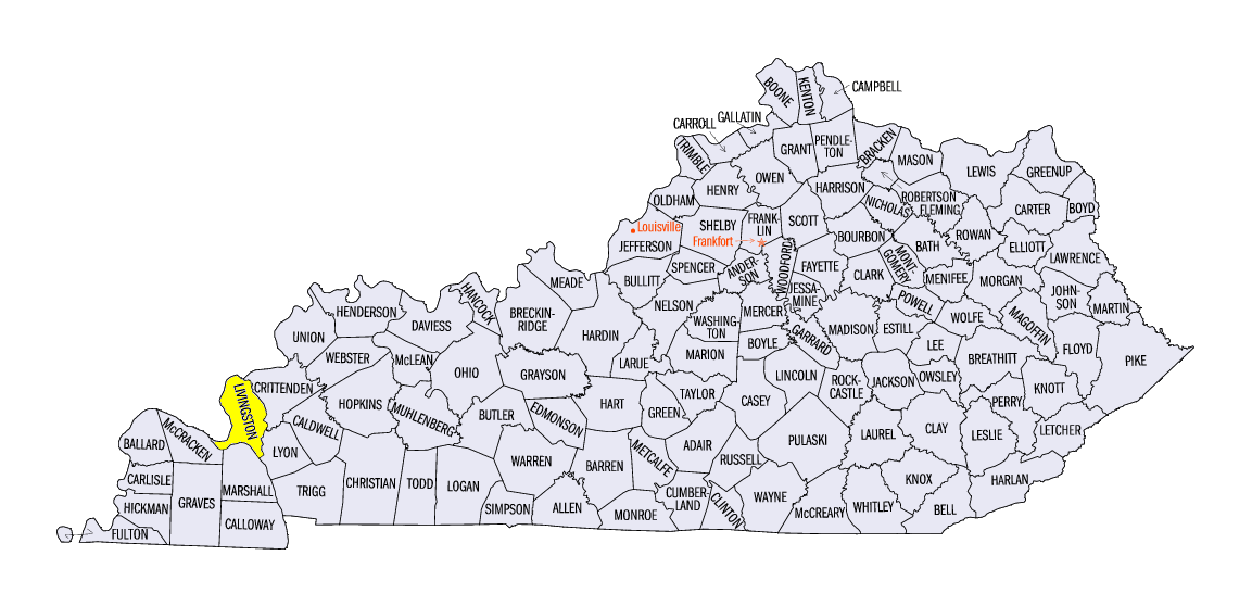
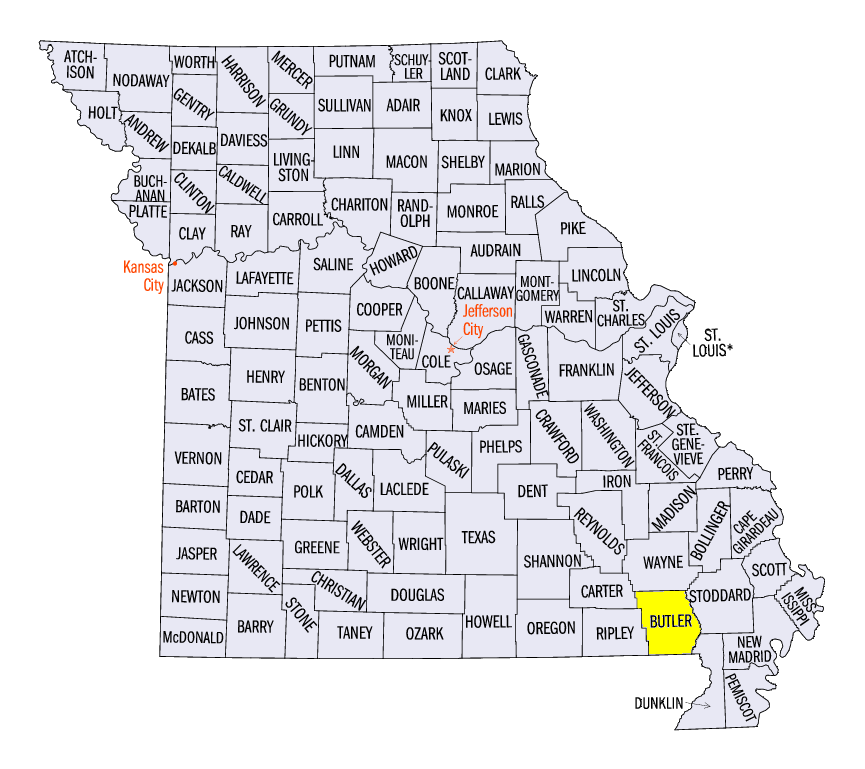
Strong spring thunderstorms on April 3 led to more than 200 severe weather reports in parts of Kentucky, Missouri, Ohio, Illinois and Indiana (Figure 16). At least 12 tornadoes were reported, including two EF-2 tornadoes. EF-2 tornadoes near Galatia, IL (Saline County) and near Burna, KY (Livingston County) had estimated winds of 125 mph. Fortunately, no injuries were reported. Strong winds were reported across Kentucky, while large hail was common in southeastern Missouri. A 2 inch diameter hailstone was reported near Poplar Bluff, MO (Butler County) in the late afternoon.
Slow Start to Growing Season
Cold weather throughout the month of March and to start the month of April has slowed growth and planting across the Midwest. According to the April 8 Crop Progress Report, each state in the Midwest had less than 2 days suitable for fieldwork for the April 2-8 period
(Figure 17). Growing Degree Days have also been slower to accumulate this spring across the southern Midwest. Only southern Kentucky has reached more than 150 growing degree days since February 1 (Figure 18). In 2017, most of the southern third of the region had reached 150 growing degree days
(Figure 19). However, with median last freeze dates approaching (Figure 20), the lack of growing degree days could protect overwintering specialty crops and vegetation from late spring freeze damage.
-BJP-