March 22-31, 2018
Midwest Weekly Highlights - March 22-31, 2018
Widespread Cold
Temperatures were below normal across almost the entire Midwest
(Figure 1). Only a few areas in southern Missouri and far northern Minnesota had temperatures slightly above normal. Iowa, Illinois, northeastern Missouri and the U.P. of Michigan were the coldest areas at 4-7°F below normal. Maximum temperatures were a major contributor to the cold, as areas in Iowa and Minnesota were as much as 10°F below normal (Figure 2). More than a dozen daily low temperature records were recorded across the region
(Figure 3).
Heavy Rain and Flooding
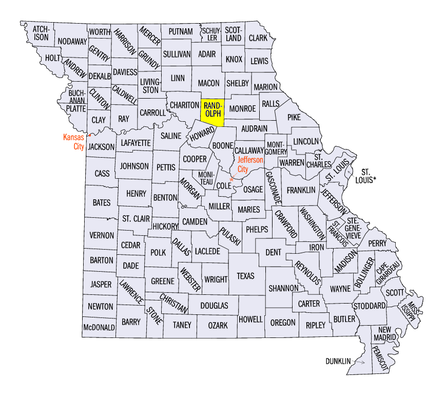
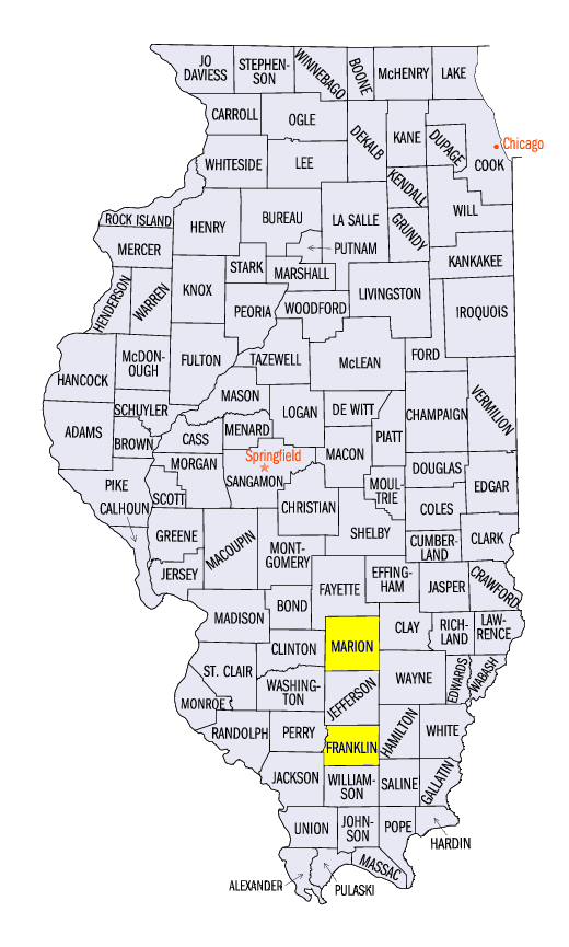
Just weeks after a major flooding event in the southern Midwest, another burst of heavy precipitation led to moderate flooding in many of the same areas (Figure 4). Areas in southern Missouri, southern Illinois, southern Indiana and Kentucky had more than three inches of precipitation during the period. Isolated areas of over four inches were reported in southern Illinois and southern Missouri as well. Some of the heaviest reported amounts included 6.17 inches in Moberly, MO (Randolph County), 5.92 inches in Patoka, IL (Marion County), and 5.61 inches in Plumfield, IL (Franklin County). While precipitation throughout the week led to the heavy totals in Illinois, most of the precipitation in Missouri was during a two-day period through the mornings of March 27
(Figure 5) and March 28 (Figure 6). More than 150 daily precipitation records were broken during the period
(Figure 7). This heavy rainfall led to minor and isolated moderate flooding in the Ohio River Valley (Figure 8). Several gauges along the Wabash River were also forecast to reach moderate flood stage during the first week of April.
Spring Snowstorms
Several spring snowstorms traveled across the Midwest during the cold last 10 days of March (Figure 9). An unpredictable and potent system moved across the Midwest on March 24 through the morning of March 25 (Figure 10). Snow fell along a very narrow line from eastern Iowa, through central Illinois, central Indiana and northeastern Kentucky, as temperatures were just cold enough for snowfall. Areas in the core of the precipitation received up to 6 inches of snow, while those 50 miles north or south of the band received little to no snowfall. Warmer temperatures and rainfall melted most of this snowfall in Illinois, Indiana and Kentucky by March 27, however (Figure 11).
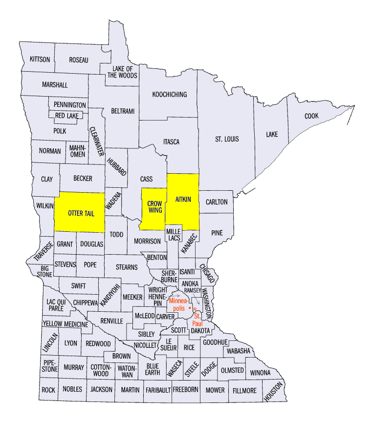
Minnesota and the U.P. of Michigan also received 6-12 inches of snow during the period. Most of this snow fell through the mornings of March 27 (Figure 12), March 31 (Figure 13), and during the day on March 31 through the morning of April 1 (Figure 14). Some of the heaviest amounts recorded in Minnesota included 20.0 inches in Ottertail (Otter Tail County), 15.0 inches near Isle (Aitkin County) and 14.0 inches in Brainerd (Crow Wing County). Snow amounts during the period were well above the normal amount (Figure 15) and often were greater than the average for the entire month of March (Figure 16). More than 100 daily snowfall records were broken during the period (Figure 17).
-BJP-