February 22-28, 2018
Midwest Weekly Highlights - February 22-28, 2018
Wet Weather in the Ohio River Valley and Minnesota
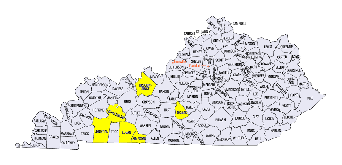
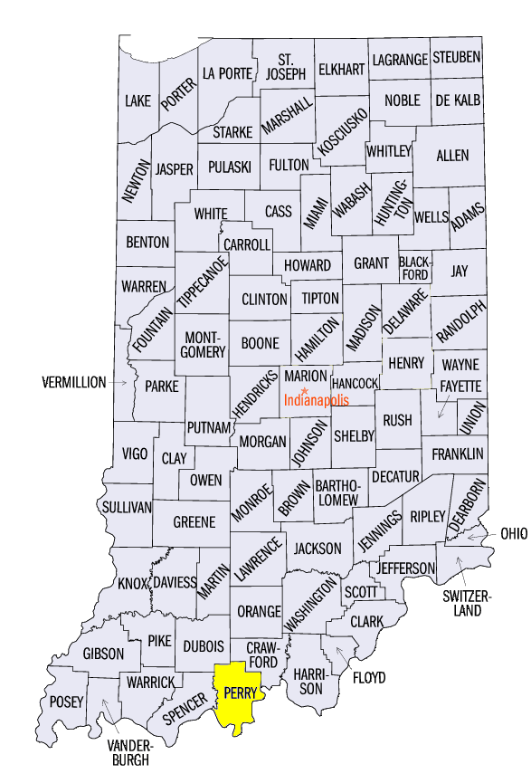
Heavy rainfall continued across the Ohio River Valley and southern Missouri, as a nearly stationary boundary that brought major flooding to Illinois and Indiana moved slowly south (Figure 1). More than an inch of precipitation fell through each of the mornings of February 22 (Figure 2), February 23 (Figure 3), February 24 (Figure 4) and February 25 (Figure 5) in these areas. Locally heavier amounts of more than 2 inches were common as well. Weekly totals of 3-5 inches were widespread, with several locations receiving more than six inches. In many cases, this was more than five times the normal amount (Figure 6). Some of the heaviest totals included 7.54 inches in Corners, KY (Breckinridge County), 7.21 inches in Powderly, KY (Muhlenberg County) and 7.08 inches in Tell City, IN (Perry County). More than 150 daily precipitation records were broken across the region (Figure 7).
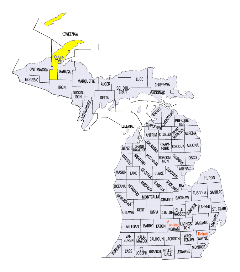
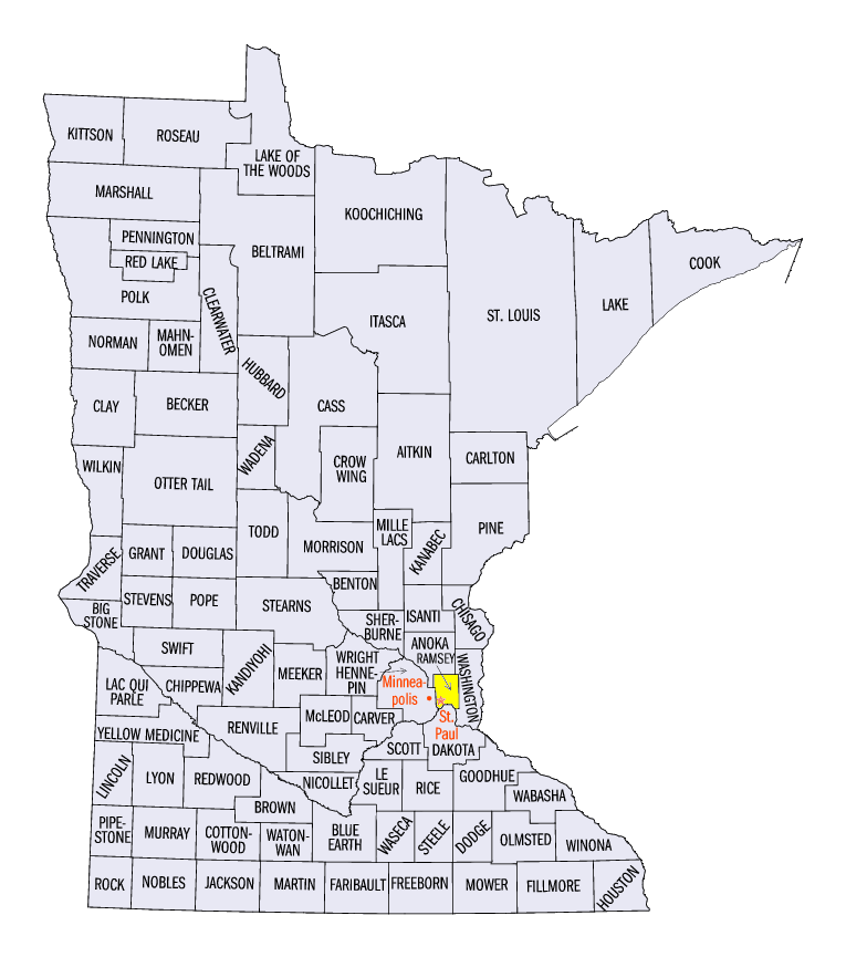
Further north, moderate to heavy snowfall fell across Minnesota, northern Wisconsin and the U.P. of Michigan (Figure 8). Amounts of 5-10 inches were common for the period, with locally heavier amounts. Most of this snowfall occurred through the mornings of February 23
(Figure 9) and February 25 (Figure 10). Some of the heaviest totals included 18.6 inches near Copper Harbor, MI (Keweenaw County), 17.0 inches in Vadnais Lake, MN (Ramsey County) and 16.0 inches in Kearsarge, MI (Houghton County). Liquid equivalent precipitation in these areas was more than twice the normal amount, while snowfall amounts were as much as five times the normal amount
(Figure 11).
Warm for Most
Temperatures were above normal for most of the Midwest during the week (Figure 12). Indiana, Kentucky, Ohio and Lower Michigan were all 8-12°F above normal, while Illinois was 6-10°F above normal. Missouri and eastern Iowa were also 2-5°F above normal. Fresh snow in Minnesota and western Iowa aided in keeping temperatures below normal in these areas. Parts of western Minnesota were as much as 7°F below normal. Several hundred daily high maximum and minimum temperature records were broken across the region
(Figure 13), with many occuring near the end of the period.
Continued Major Flooding
Major and moderate flooding continued across Illinois, Indiana, southern Lower Michigan and the Ohio River Valley this week (Figure 14). Rainfall from the previous week had already brought several gauges to record flood stage. More gauges in northern Illinois and Indiana reached their crest in the current week. By the end of the period, most of these rivers receded to moderate flood stage, with exceptions along the Kankakee River in Indiana
(Figure 15), and the Rock River in Illinois (Figure 16). Several days of heavy rain in the Ohio River Valley also led to moderate flooding along the Ohio River and many of its tributaries. Gauges along the Ohio River at Cairo, IL (Figure 17, Alexander County) and near Grand Chain, IL (Figure 18, Pulaski County) reached major flood stage. A flood fatality occurred in Simpson County, KY from rainfall that occurred on February 24. Several more fatalities occurred from being swept away in flood waters or in submerged vehicles. Combined with tornadoes in Kentucky, at least six fatalities were reported from the storms.
Kentucky Tornadoes
More than a dozen tornado reports were reported in Kentucky on February 24, including four EF-2 tornadoes
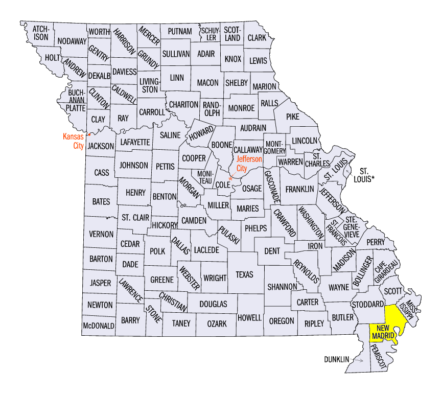
(Figure 19). The worst of these tornadoes was near Adairville, KY (Logan County), where one injury and one fatality were reported. Large farm equipment and vehicles were thrown hundreds of yards, while roofs of houses and buildings were blown away. The tornado traveled 11 miles from the border of Tennessee, travelling to the north of Adairsville, with estimated peak winds reaching 135 mph. A similar EF-2 tornado tore through southeastern Hopkinsville, KY (Christian County) later in the evening. Estimated peak winds were 135 mph, with nine injuries. Apartment buildings were destroyed, while cars were flipped and businesses sustained major damage. An EF-2 tornado near Mathews, MO (New Madrid County) caused two injuries while destroying semi-trailers. Near Greensburg, KY (Green County), an EF-2 tornado briefly touched down during the overnight hours. Fortunately no injuries were reported. Several more EF-1 and EF-0 tornadoes were reported in Kentucky, as well as report in southeastern Ohio.
Drought Improves in Illinois and Missouri
Major improvements were noted in the February 27 U.S. Drought Monitor across southern Illinois and Missouri (Figure 20). Severe and Extreme Drought were eliminated, while two category improvements were common across these areas. Drought area in the region decreased from 13 percent to less than five percent. Precipitation deficits since December 1 (Figure 21) were virtually wiped out from the heavy rainfall during the past two weeks (Figure 22). Before the rain began, most of Illinois, Missouri, and Indiana had less than three-quarters the normal amount of precipitation, with some areas receiving less than half. Abnormally dry conditions remain across most of Missouri and southeastern Iowa, however, as longer term deficits remain. Improvements to abnormally dry conditions were also observed in Minnesota, as heavy snow fell across the state.
February 25 Strong Winds
Strong winds were common across the Midwest as a new air mass filled into the region (Figure 23). Sustained winds of 25-35 mph were common across eastern Iowa, southern Wisconsin, Illinois, Indiana, Michigan and western Ohio. Several stations had winds of more than 40 mph. Wind gusts in the 45-55 mph range occurred in southeastern Wisconsin and northern Indiana as well.
-BJP-