February 15-21, 2018
Midwest Weekly Highlights - February 15-21, 2018
Heavy Rainfall
A nearly stationary winter storm brought excessive rainfall to parts of Missouri, Illinois, Indiana and Lower Michigan (Figure 1). More than two inches of precipitation fell across most of these areas, with southern Missouri, central Illinois, northern Indiana and southwestern Lower Michigan receiving more than three inches. In many cases, this was three to five times the normal amount (Figure 2). Measurable snowfall was observed across most of the region, with several inches in northern Illinois and Indiana, and 3-6 inches across most of Minnesota (Figure 3). Areas in northern Minnesota received more than 10 inches.
Significant amounts of rainfall fell on several different days during the period. Ohio and southern Indiana were the first to receive heavy rain during the period, as over an inch fell through the morning of February 16 (Figure 4). The most significant rainfall during the period occurred through the mornings of February 20
(Figure 5) and February 21 (Figure 6). Two-day totals in the 3-5 inch range were common in east-central Illinois, northwestern Indiana and southwestern Lower Michigan
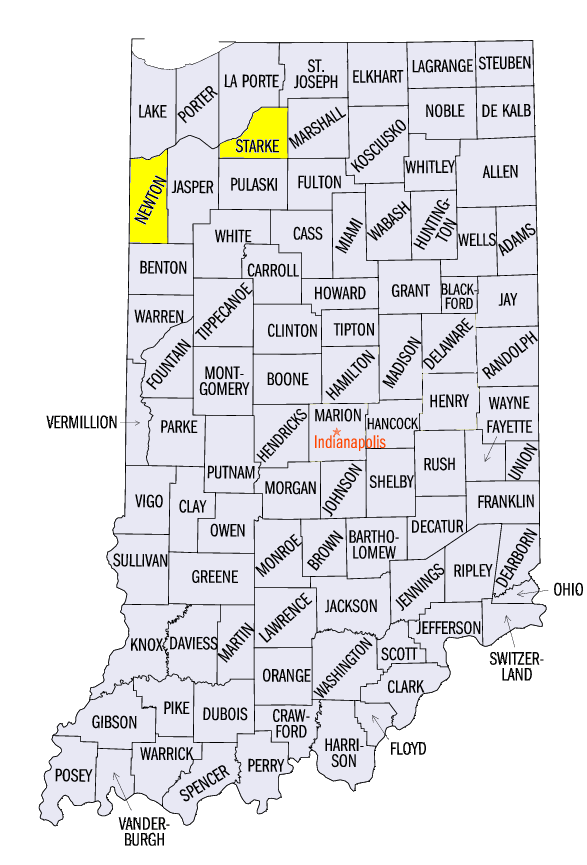
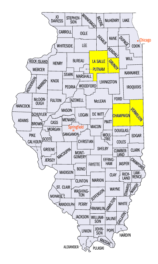
(Figure 7). Some of the heaviest two-day totals included 6.53 inches near North Judson, IN (Starke County), 6.45 inches in Ogden, IL (Champaign County) and 6.06 inches near Lake Village, IN (Newton County). More than 150 daily precipitation records were broken on February 20 (Figure 8), with more than 100 more on February 21
(Figure 9). In total, more than 350 daily precipitation records were broken across the region during the period (Figure 10).
Major Flooding
Excessive rainfall coupled with snow melt led to widespread flooding across northern Illinois, northern Indiana, southern Wisconsin, southern Lower Michigan and Ohio during the week (Figure 11). A winter storm from February 8-12 dumped more than a foot of snow on areas in northern Illinois, with similar amounts in northwestern Indiana and southwestern Lower Michigan. On the morning of February 18, 2-6 inches of snow was still on the ground (Figure 12). Soil temperatures were also near freezing, exacerbating runoff (Figure 13). As heavy rain began to fall on February 19, flood watches and warnings were issued in northern Illinois, northern Indiana southern Lower Michigan.
Many stream gauges reached flood stage in southern Wisconsin, northern Illinois, northern Indiana and southern Lower Michigan (Figure 14). Dozens of gauges reached moderate flood stage, while several rivers reached major flood stage. The Illinois River at Ottawa (Figure 15, LaSalle County) and at Morris (Figure 16, Grundy County) reached major flood stage on February 21. Smaller rivers including the Kankakee and Iroquois rivers in Illinois and Indiana
(Figure 17) (Figure 18), Yellow in Indiana
(Figure 19), and St. Joseph in Michigan and Indiana (Figure 20) also reached major flood stage, with some gauges breaking records. Many other rivers were forecast to crest near or above major flood stage during the final week of February. Evacuations were ordered for some residents in low-lying areas along rivers, including a trailer park in Danville, IL (Vermilion County).
Stark Temperature Contrast
Very warm weather was observed across the Ohio River Valley this week (Figure 21). Temperatures 10°F or more above normal were widespread across southern Indiana, Ohio and Kentucky. Parts of Ohio and eastern Kentucky were more than 15°F above normal. Most of Lower Michigan, southern Illinois and southern Missouri were also 5-8°F above normal. Maximum temperatures reached the upper-60s and 70s on multiple days, with some stations in Kentucky reaching 80°F on February 20. More than 400 daily high maximum and minimum temperatures were broken in total during the period (Figure 22). Meanwhile, the Upper Midwest was colder than normal. Areas in northwestern Minnesota were as much as 7°F below normal. Western Iowa and northwestern Wisconsin were also a few degrees below normal.
Drought Improvement Ahead
Slight improvements in southern Illinois and eastern Missouri were observed according to the January 20 U.S. Drought Monitor (Figure 23). Moderate drought coverage in Illinois dropped nearly 10 percent (Figure 24) from the previous week. Severe drought area also decreased in Missouri by six percent (Figure 25).
With the heavy rainfall that occurred after the morning of January 20 cutoff for the U.S. Drought Monitor, more improvement was expected in upcoming weeks. Less than half of normal precipitation fell since January 1 in parts of Missouri, central Illinois and central Indiana prior to the heavy rainfall event (Figure 26). After the event concluded, many of these areas had near- to above-normal precipitation for 2018 (Figure 27). Longer term deficits remain, however, as spring nears.
-BJP-