February 8-14, 2018
Midwest Weekly Highlights - February 8-14, 2018
Cold, Except in the Ohio River Valley
Temperatures were colder than normal across the western and northern parts of the Midwest during the week
(Figure 1). Iowa and Minnesota were the coldest states, with areas 8-12°F below normal. Wisconsin and northern Illinois were also 5-8°F below normal. Most of Missouri and Michigan were 2-5°F below normal. In the Ohio River Valley, warmer than normal temperatures were observed. Some of the warmest areas were in eastern Kentucky, where temperatures were 4-7°F above normal.
Swaths of Snow and Rain
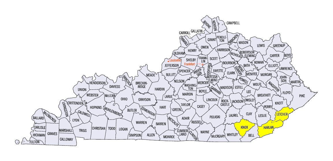
Precipitation was largely confined to two main areas across the central Midwest and the eastern Ohio River Valley (Figure 2). Several inches of rain fell in southeastern Kentucky, with locally heavier amounts of more than four inches. This was more than twice the normal amount
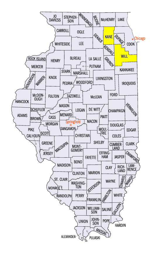
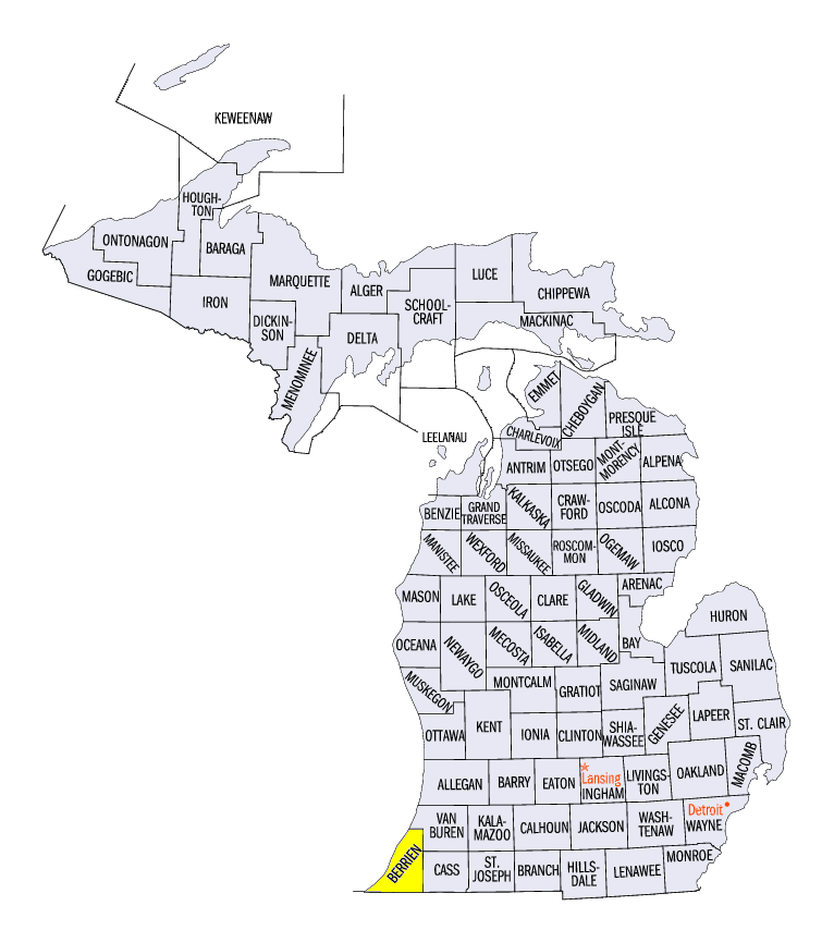
(Figure 3). Some of the heaviest totals for the week included 5.61 inches near Harlan, KY (Harlan County), 4.90 inches in Barbourville, KY (Knox County) and 4.45 inches near Whitesburg, KY (Letcher County). Most of this rainfall fell through the morning of February 11 (Figure 4). In the central Midwest, a major snowstorm led to above-normal liquid precipitation. Snowfall amounts of 5-8 inches were common from Iowa through Lower Michigan, with amounts over a foot in northeastern Illinois and southwestern Lower Michigan
(Figure 5). This was two to five times the normal amount (Figure 6).
February 8-12 Winter Storm
A major winter storm from Iowa through Lower Michigan dropped 5-8 inches of snowfall on February 8-12
(Figure 7). The system moved through the region at a very slow pace, which led to large weekly totals of more than a foot in northern Illinois and southwestern Lower Michigan. Some of the heaviest totals included 17.0 inches in Aurora, IL (Kane County), 15.6 inches near Stevensville, MI (Berrien County) and 15.0 inches near Joliet, IL (Will County). The highest one-day total was 8.0 inches for both stations. The majority of the snowfall fell through the morning of February 9 (Figure 8) and February 10
(Figure 9) in Iowa and southern Minnesota. Snowfall continued through the morning of February 11 (Figure 10) in northern Illinois, southeastern Wisconsin and Lower Michigan before beginning to taper off by the morning of February 12
(Figure 11). The Chicago area received 0.2 inches of snowfall or more for nine consecutive days from February 3-11. This was the longest such stretch on record for the city.
Drought Slowly Expands
Areas in the Midwest considered in drought increased to over 14 percent of the region in the latest U.S. Drought Monitor (Figure 12). This was the fourth consecutive week that drought area increased for the Midwest region. Moderate drought was introduced in south-central Illinois, while severe drought was added in east-central Missouri. Winter has been very dry in these areas, with less than half the normal amount of precipitation in parts of Missouri, Illinois and Indiana (Figure 13).
-BJP-