September 24-30, 2019
Midwest Weekly Highlights - September 24-30, 2019
More Summer Warmth
Temperatures remained well above normal across the southern Midwest during the week
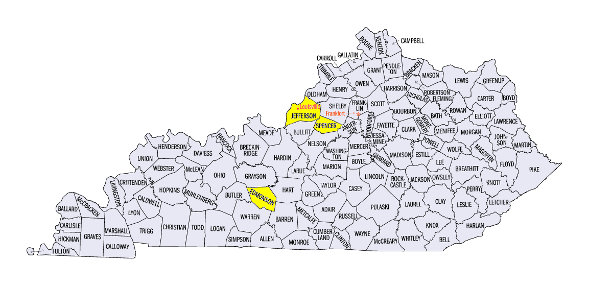
(Figure 1). Most of Missouri, southern Illinois, and the Ohio River Valley were 8-10°F above normal. Most of Iowa, Wisconsin and Michigan were also 3-5°F above normal as well. Only a few areas in northern Minnesota were slightly below normal. Maximum temperatures in the upper 80s and 90s were common across the southern Midwest, with upper 90s also reported on September 29 (Figure 2). In Kentucky, Louisville (Jefferson County), Nolin River Lake (Edmonson County) and Taylorsville Lake (Spencer County) all reached 98°F late in the period. More than 280 daily high temperature records were broken, mainly in the southern Midwest
(Figure 3).
Heavy Rain Shifts South
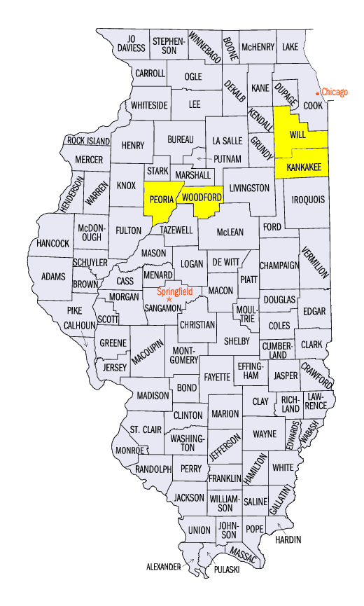
Wetter weather shifted slightly further south during the period, bringing heavy rain to northern Missouri, southern Iowa, northern Illinois and northern Indiana (Figure 4). Amounts of 2-4 inches were common with locally heavier amounts over 6 inches. Some of the heaviest totals for the period included 10.64 inches in Minonk, IL (Woodford County), 8.67 inches in Peotone, IL (Will County) and 8.56 inches near Peoria, IL (Peoria County). Amounts across this swath of rain were 3-7 times the normal amount
(Figure 5). A large portion of this rain fell through the morning of September 28 (Figure 6), with flash flooding occuring in the areas with the heaviest rainfall. More than 160 daily precipitation records were broken during the period
(Figure 7). Meanwhile, the southern Midwest was very dry. Little to no precipitation fell across southern Illinois, southern Indiana and Kentucky.
Severe Drought Introduced in Kentucky
A dry month of September in Kentucky contributed to the expansion of moderate drought and the introduction of severe drought in the September 26 U.S. Drought Monitor (Figure 8). This was the first time since October 9, 2018 that severe drought was impacting the Midwest. Temperatures in the 90s were common in September. Precipitation deficits in the past 60 days were also listed as contributing factors. Meanwhile, increased rainfall in the Upper Midwest, led to reduction of drought and abnormally dry conditions in Michigan and Iowa. Overall, nearly five million people were estimated to be living in drought affected areas.
Severe Thunderstorms
Strong storms across the Midwest led to more than 180 reports of hail, thunderstorm winds and tornadoes during the period
(Figure 9). Most of these reported were from storms on September 24 (Figure 10) and September 27
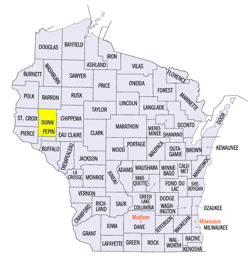
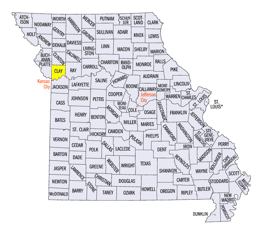
(Figure 11). Tornadoes impacted Iowa, Minnesota and Wisconsin on September 24, with the strongest an EF-3 tornado near Elk Mound, WI (Dunn County). Structures were completed destroyed and pine trees were leveled. Two injuries were also reported. A wind gust of 80 mph was also reported in Zumbro Falls, MN (Wabasha County) on September 24. On September 27, hail and storm winds were reported from northern Missouri through northern Illinois. Hail stones of 2.5 inches in diameter were reported near Grant Park, IL (Kankakee County), Smithville, MO (Clay County) and Liberty, MO (Clay County). A 70 mph wind gust was also reported in Peoria, IL (Peoria County).
)
-BJP-