June 1-9, 2019
Midwest Weekly Highlights - June 1-9, 2019
Warm for Most
Temperatures were above normal for most of the Midwest during the week
(Figure 1). The warmest areas were in Minnesota, where average temperatures of 4-6°F above normal were common. Only areas in northern Lower Michigan and the Arrowhead of Minnesota were below normal.
Drying Out
Lower amounts of precipitation aided farmers still attempting to plant across the Midwest during the week (Figure 2). Less than an inch of rain fell across large portions of Minnesota, Wisconsin, Iowa, Illinois, western Missouri and Indiana. Many of these areas had less than half the normal amount for the period, with parts of western Iowa and the U.P. of Michigan receiving less than a quarter
(Figure 3). A few wetter areas were found in Lower Michigan, northern Ohio and Kentucky. Wetter weather in Kentucky alleviated some concerns from abnormally dry conditions that were added to the U.S. Drought Monitor (Figure 4). The Midwest remained drought-free once again in the June 4 U.S. Drought Monitor, continuing the drought-free calendar year in the region. Despite drier weather, major and moderate flooding remained common along the Mississippi, Illinois and Missouri rivers
(Figure 5).
Widespread Severe Weather
Hundreds of wind and hail reports affected every state in the Midwest during the week (Figure 6). More than 300 reports of thunderstorm wind damage and 150 reports of hail were reported. Many of these reports occurred on June 1
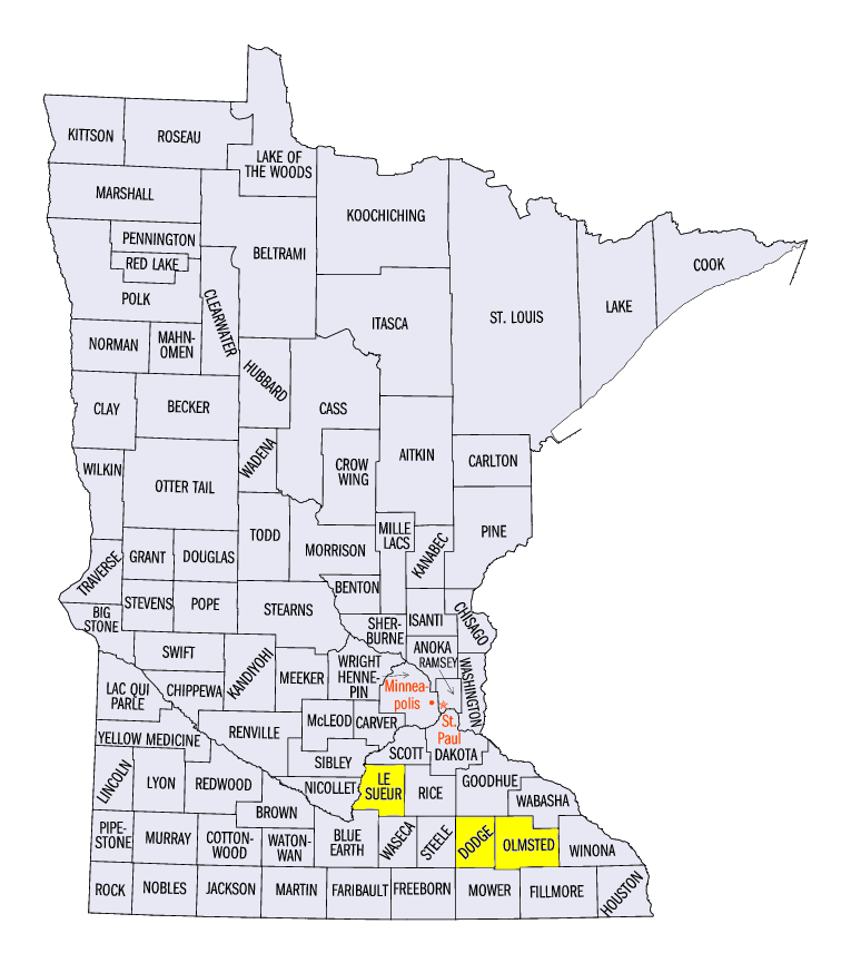
(Figure 7), where strong winds and hail were concentrated in Missouri, Ohio, northern Indiana and southern Lower Michigan. Strong thunderstorms impacted Minnesota on June 4 (Figure 8), with several significant reports of hail and winds. A 2.75 inch diameter hailstone was reported in Kasson, MN (Dodge County) while an 85 mph wind gust was reported at Union Hill, MN (Le Sueur County). An EF-1 tornado was also confirmed near Rochester, MN (Olmstead County), causing damage to trees and significant damage to a home. As the system moved south on June 5, strong winds and hail were reported across the Ohio River Valley and northern Missouri
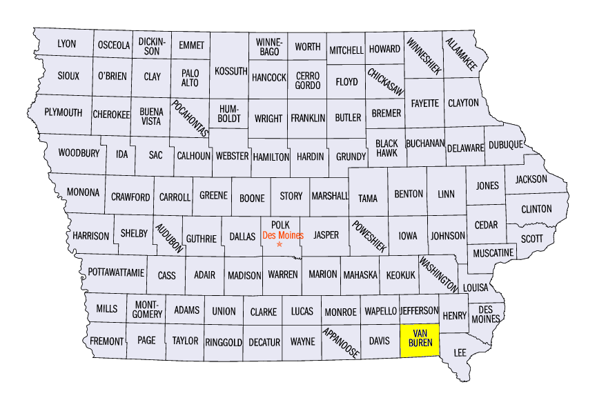
(Figure 9). Significant hail was reported in Keosauqua, IA (Van Buren County), where 2.75 inch diameter hail knocked out windows in the local high school. Several very weak tornadoes and land spouts were reported on June 9 in eastern Iowa as well. Little to no damage was reported along their paths.
Late Planting Progresses
With drier weather, opportunity to plant across the Midwest increased during the week as farmers attempted to catch up (Figure 10). A large chunk of the corn crop was planted during the week, with 10-30 percent planted in several states. Indiana was the largest week to week increase from 31 percent on June 2 to 67 percent planted for the week ending June 9. On average, 95 percent or more of the corn crop has been planted by this week, while significant departures of 20-30 percent still remain across the region. Soybeans were also planted, but remained significantly behind across most of the region
(Figure 11).
-BJP-