March 11-17, 2019
Midwest Weekly Highlights - March 11-17, 2019
Warmth Returns
After a cold end to February and first week of March, warmer weather returned to a large portion of the Midwest
(Figure 1). Most of Ohio, Kentucky, Indiana and eastern Lower Michigan were 2-4°F above normal, while Illinois and parts of Iowa and Wisconsin were 1-2°F above normal. Colder temperatures remained across portions of Minnesota, However. More than a foot of snow remained on the ground across northern Minnesota, which allowed temperatures to remain cooler (Figure 2).
More Wet Weather
Moderate to heavy amounts of precipitation fell once again across a large portion of the western Midwest during the week
(Figure 3). Portions of Missouri, Illinois, western Iowa, northern Wisconsin and Minnesota had more than twice the normal amount during the period (Figure 4). Most of Minnesota and northwestern Iowa had 3-5 times the normal amount. More than 125 daily precipitation records were broken during the period
(Figure 5). Warmer temperatures meant that most of this precipitation fell as rain over snowfall. Only a few areas in the U.P. of Michigan and northwestern Minnesota received more than 4 inches of snow during the period (Figure 6).
Mississippi and Missouri River Flooding
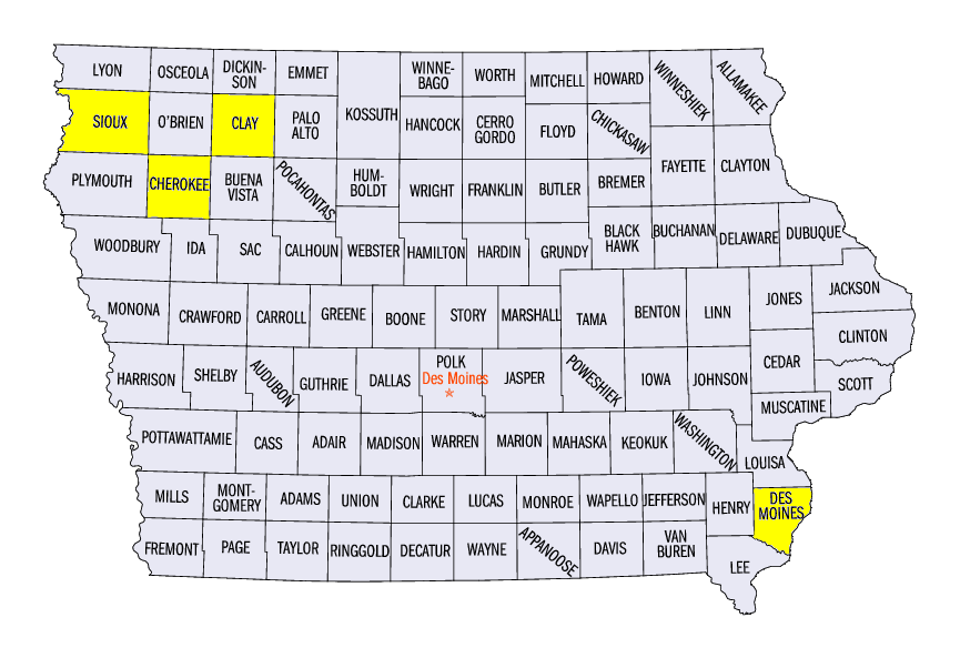
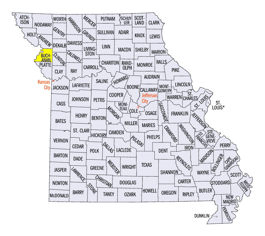
Heavy rainfall and melting snow in the Upper Midwest caused major flooding along the Mississippi and Missouri rivers and their tributaries during the week (Figure 7). The worst of this flooding occurred on the Missouri River along the Iowa and Nebraska border. Several levees along the river failed, causing water to flow freely into communities along the river. Several of the river gauges that broke their record crests included the Little Sioux River at Cherokee, IA (Figure 8, Cherokee County), the Big Sioux River near Hawarden, IA (Figure 9, Sioux County), the Missouri River at Nebraska City, NE (Figure 10), the Missouri River at Plattsmouth, NE (Figure 11) and the Ocheyedan River near Spencer, IA (Figure 12, Clay County). Major flooding on the Missouri River was also observed in far northeastern Missouri as well, with major flooding forecast to occur through St. Joseph, MO (Buchanan County) in the following week.
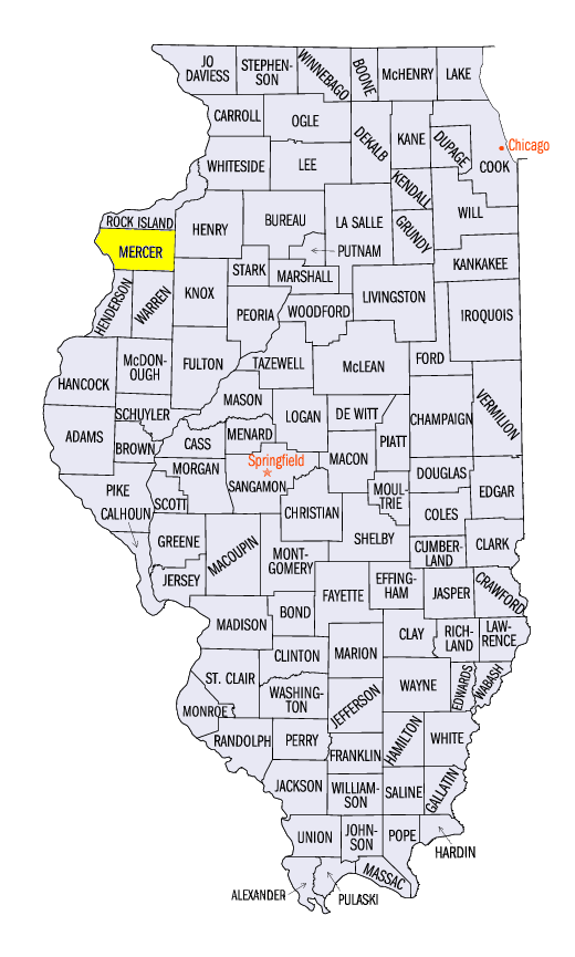
On the Mississippi River, moderate to major flooding occurred from the Quad Cities through the Illinois, Iowa and Missouri tristate area. Major flooding occurred from New Boston, IL (Figure 13, Mercer County) through Burlington, IA (Figure 14), Des Moines County). Major flooding on tributaries was also recorded, including the Pecatonica (Figure 15), Rock (Figure 16), Wapsipinicon (Figure 17) and Cedar (Figure 18) rivers.
Impacts were widespread in Iowa, Illinois, Missouri and Wisconsin. At least three deaths were attributed to the flooding in western Iowa and Nebraska. A state of Emergency was declared for both Wisconsin and Iowa, with dozens of counties in disaster proclamations. Hundreds of homes were destroyed or damaged. Many highways in Wisconsin were also impassible. Millions of dollars in damage across the region was expected after surveys were completed.
March 13-14 Bomb Cyclone
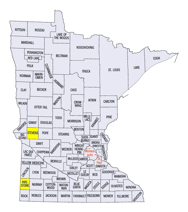
A significant cyclone that underwent rapid intensification impacted the High Plains and Midwest on March 13-14. Strong winds, heavy rain, severe weather and tornadoes were all reported from the storm. Heavy precipitation over an inch fell through the mornings of March 13 (Figure 19), March 14 (Figure 20) and March 15 (Figure 21). Some of the heaviest amounts fell in western Kentucky, where amounts over 3 inches fell. Sustained wind speeds of 40-45 mph were common in parts of Minnesota, Iowa and Illinois as the storm moved eastward on March 14 (Figure 22). Some of the strongest wind gusts included 61 mph in Burlington, IA (Des Moines County), 54 mph at Pipestone, MN (Pipestone County) and 53 mph in Morris, MN (Stevens County).
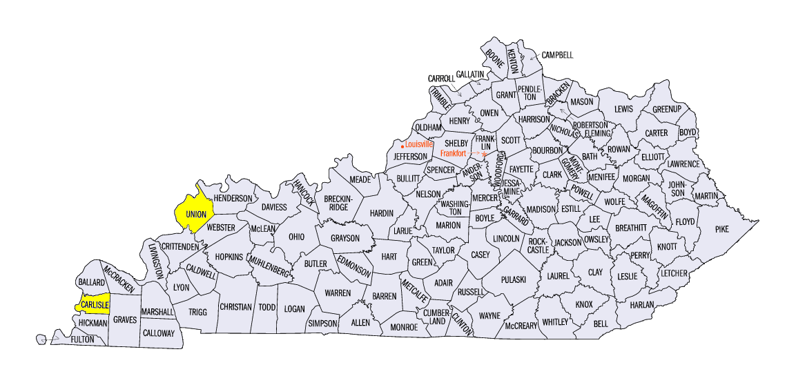
Severe weather followed two distinct paths on March 14 along the Ohio River and from northwestern Illinois through southern Lower Michigan (Figure 23). More than 175 reports of strong thunderstorm winds and large hail were recorded. Tornadoes were reported in northwestern Kentucky and southern Indiana, as well as in northeastern Ohio and central Michigan. The strongest of these tornadoes near Cunningham, KY (Carlisle County) was rated EF-2 with an estimated wind speed of 125 mph. An EF-1 tornado was also reported near Morganfield, KY (Union County). An injury was reported with each of these tornadoes. Several other EF-0 tornadoes were reported.
-BJP-