February 8-14, 2019
Midwest Weekly Highlights - February 8-14, 2019
Cold Air Returns
Temperatures cooled across most of the Midwest after a brief warm-up in the first week of February
(Figure 1). The coldest areas were in Minnesota, where most of the state was 8-13°F below normal. Most of Iowa and Wisconsin were 3-7°F below normal as well. Several dozen daily low temperature records were broken as a result in the Upper Midwest (Figure 2). The Ohio River Valley was warmer, however, with temperatures 1-3°F above normal.
Wetter Weather
Rain across the southern Midwest and plentiful snowfall in the Upper Midwest led to high precipitation amounts for the region
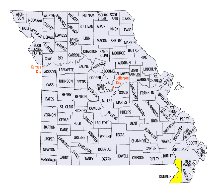
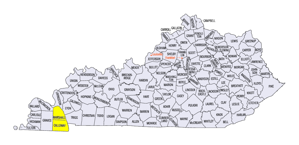
(Figure 3). Along the Ohio River Valley, amounts of 2-4 inches of precipitation were common, with isolated amounts of over 5 inches. Some heavier amounts included 7.00 inches at Hornersville, MO (Dunklin County), 6.10 inches in Murray, KY (Calloway County) and 5.24 inches at Kenlake Resort, KY (Marshall County) In Michigan and Wisconsin, more than an inch of liquid equivalent precipitation fell in the form of snow. This led to precipitation amounts that were 3-5 times the normal amount across these areas (Figure 4). More than 200 daily precipitation records were broken during the period
(Figure 5). Most of these records occurred on February 12, where precipitation amounts were very high across the entire region (Figure 6). Snowfall amounts were very high across the Upper Midwest
(Figure 7). Areas in Wisconsin and the U.P. of Michigan received more than 20 inches combined from snowfall on February 8 (Figure 8), and a storm that spanned for February 11-13
(Figure 9). More than 300 daily snowfall records were broken during the period as well (Figure 10).
February 11-13 Winter Storm
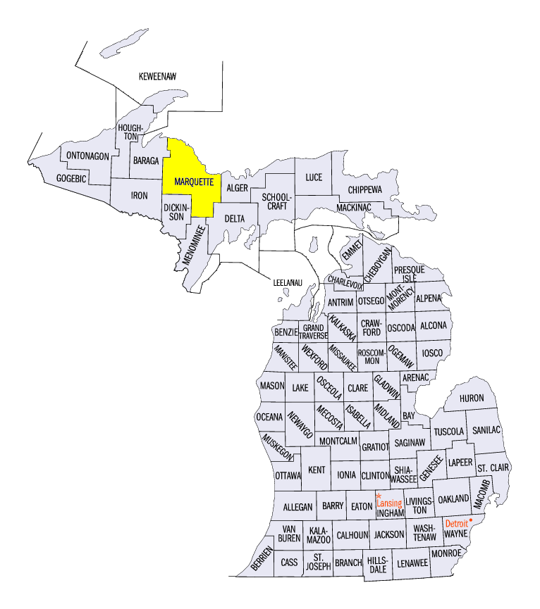
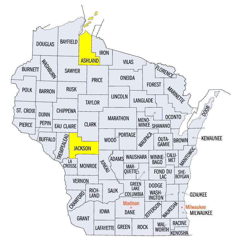
While heavy rain fell across the Ohio River Valley, moderate to heavy snowfall fell across the Upper Midwest on February 11-13. The first round of snow fell through the morning of February 11, with parts of southern Minnesota and northern Wisconsin receiving 3-5 inches (Figure 11). Measurable snowfall was observed across most of the northern two-thirds of the region as the storm moved in. During the day on February 11 through the morning of February 12, moderate to heavy snow fell across Iowa, Minnesota and Wisconsin (Figure 12). Eastern Iowa and central Wisconsin received 6-8 inches, while other areas received 3-5 inches. As the storm moved to the northeast, lake enhancement aided snowfall totals in northern Wisconsin and Michigan through the morning of February 13 (Figure 13). Amounts of 6-10 inches were common with isolated amounts over a foot. Some of the heaviest storm total amounts included 26.1 inches near Marquette, MI (Marquette County), 22.2 inches in Black River Falls, WI (Jackson County) and 22.0 inches near Butternut, WI (Ashland County).
Further south, ice formed as freezing rain fell from northern Illinois through northern Ohio on February 12. Reports of a tenth to two-tenths of an inch of ice were common. Strong winds accompanied the storm with wind gusts of 40-45 mph.
Impacts were felt across the Upper Midwest from the storm. Many schools were closed and roads became near impassable. Accidents and slide-offs were reported. More than 30,000 households were without power across northern Indiana due to ice and high winds toppling trees and power lines.
-BJP-