October 25-31, 2020
Midwest Weekly Highlights - October 25-31, 2020
Widespread Chill
Temperatures were cold across the Midwest during the last week of October
(Figure 1). The entire western half of the region was 9°F or more below normal, with areas in western Iowa and southwestern Minnesota 13-14°F below normal. Most of the northern Ohio River Valley was 2-6°F above normal while the only areas in the region above normal were in southeastern Kentucky. The result of the cold temperatures across the western Midwest led to a shocking number of daily records (Figure 2), with more than 680 daily low maximum temperature records and more than 170 daily low minimum records. More than 100 daily low maximum temperature records were broken each day from October 25-29 and included more than 200 daily low maximums through the morning of October 27
(Figure 3).
Hurricane Zeta Brings Precipitation
An otherwise dry week with high pressure dominating across the Midwest changes as the remnants of Hurricane Zeta impacted the southern half of the region (Figure 4). Most of this precipitation fell through the mornings of October 27-30, with the heaviest precipitation falling through the mornings of October 27
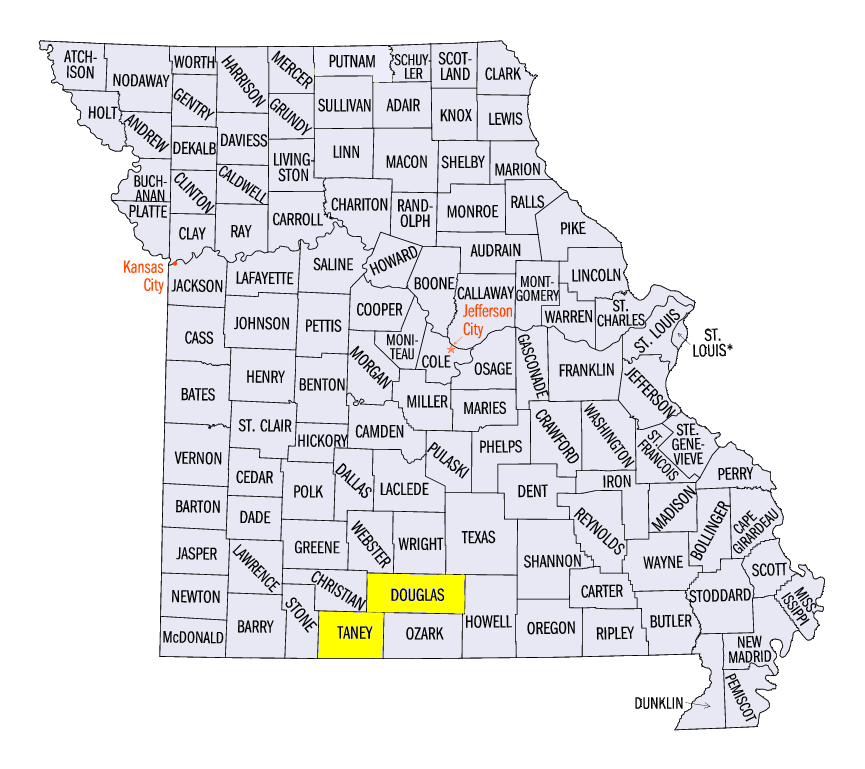
(Figure 5) and October 30 (Figure 6). Amounts of 3-5 inches were common throughout southern Missouri and into the western Ohio River Valley. Some of the heaviest amounts included 7.38 inches in Branson, MO (Taney County), 7.33 inches near Wasola, MO (Douglas County) and 6.94 inches in Ozark Beach, MO (Taney County). Precipitation in these areas were more than three times the normal amount
(Figure 7). Meanwhile, most areas in the central and northern Midwest had less than half an inch of precipitation, except for the U.P. of Michigan. In many cases, this was less than half the normal amount.
Cold Leads to Snow
Colder temperatures in the western Midwest led to snowfall from northern Missouri through the U.P. of Michigan (Figure 8). Amounts of up to an inch fell in Missouri, with some areas in northwestern Iowa and southwestern Minnesota had more than three inches. Lake-effect snowfall in the U.P. of Michigan led to more than 6 inches in some areas. Most of this snowfall occurred through the morning of October 26
(Figure 9), with some in Missouri on October 27 (Figure 10).
Drought Improves Slightly
Rainfall in areas of Missouri, Iowa and Indiana ahead of the October 27 U.S. Drought Monitor led to a decrease of more than 3.5 percent across the Midwest
(Figure 11). This included the elimination of extreme drought in southwestern Missouri and severe drought in central Illinois. Abnormally dry conditions also dropped by more than 10 percent across the region.
-BJP-