October 18-24, 2020
Midwest Weekly Highlights - October 18-24, 2020
Exceptional Cold Moves In
Temperatures were sharply colder across the Upper Midwest during the period with contrasting warmer temperatures across the Ohio River Valley
(Figure 1). Areas in Minnesota were 13-16°F below normal, with most of northern Wisconsin and Iowa more than 10°F below normal. A large portion of Minnesota had maximum temperatures average more than 16°F below normal (Figure 2), with some areas in southwestern Minnesota more than 20°F below normal. Most of this cold air stayed in the western half of the region, however, as a potent storm system stalled over the central Midwest. Colder temperatures only moved into the Ohio River Valley as the cold front of the system advanced through the morning of October 24
(Figure 3). More than 380 low temperature records were broken in the western Midwest (Figure 4), with 350 of these records coming from low maximum temperatures. Meanwhile, more than 80 records were broken across the southern half of the region
(Figure 5).
Heavy Precipitation
A stalled storm system brought heavy precipitation to the Midwest during the week (Figure 6). A stationary front set up across the southern Midwest early in the week and brought rainfall amounts over 2 inches to western and northern Kentucky on October 20
(Figure 7). The boundary slowly moved northward through the mornings of October 21 (Figure 8), October 22
(Figure 9) and October 23 (Figure 10), resulting in precipitation amounts of 1-3 inches in many areas, with amounts over 5 inches in some areas. Precipitation from this storm likely had an impact in areas highlighted in the October 20 U.S. Drought Monitor
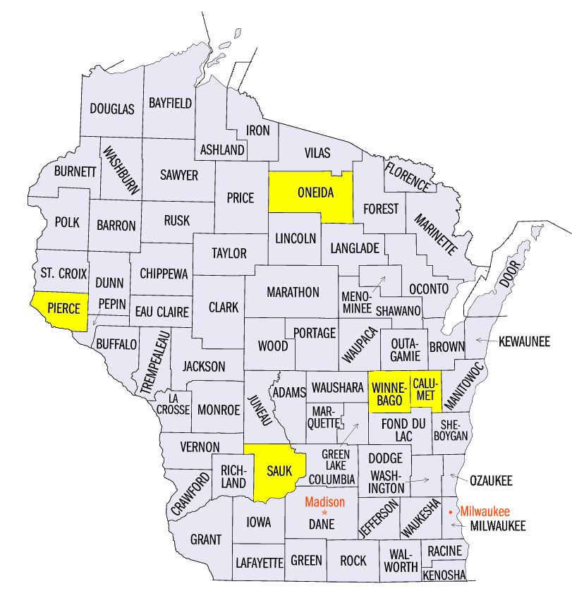
(Figure 11). Some of the heaviest amounts fell in Wisconsin and included 5.48 inches in Brillion (Calumet County), 5.20 inches in Sauk City (Sauk County) and 5.18 inches in Oshkosh (Winnebago County). Precipitation in the wettest Wisconsin areas was more than five times the normal amount (Figure 12). More than 225 daily precipitation records were broken across the Midwest
(Figure 13).
Record October Snowfall
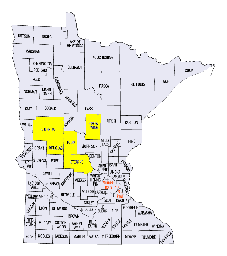
A record-breaking October snowstorm impacted the Upper Midwest with amounts near to over a foot in some areas of Minnesota (Figure 14). Exceptional cold in the Upper Midwest coupled with a largely stationary storm system led to these amounts. Some of the heaviest amounts for the week included 15.6 inches in Alexandria, MN (Douglas County), 14.8 inches in Long Prairie, MN (Todd County), 13.0 inches in Ottertail, MN (Otter Tail County), and 12.0 inches near Ellsworth, WI (Pierce County). Most of this snow fell through the mornings of October 21
(Figure 15) and October 23 (Figure 16). Most of Minnesota and northern Wisconsin had 4-6 inches on October 21. A 6-inch one-day snowfall had never happened in October in most of these areas (Figure 17). Overall, more than 157 daily snowfall records were broken (Figure 18), while more than 50 monthly records for October were broken from the storm. Some of these October records included Minneapolis-St. Paul, MN, St. Cloud, MN (Stearns County), Brainerd, MN (Crow Wing County) and Rhinelander, WI (Oneida County).
Severe Weather October 23
Along the cold front of the major storm that impacted the Midwest on October 23, strong winds and hail led to damage in Michigan, northern Ohio and scattered parts of the Ohio River Valley
(Figure 19). Winds speeds reached 50-60 mph, which toppled trees and downed power lines. Hail of 1-inch in diameter was also reported in several areas. In total, more than 60 reports of wind and hail were reported across the region.
-BJP-