October 11-17, 2020
Midwest Weekly Highlights - October 11-17, 2020
Mixed Temperatures
Temperatures were slightly cooler across the Upper Midwest and near- to slight above normal in the southern parts of the region during the week
(Figure 1). Some of the coldest areas were in northeastern Minnesota and the U.P. of Michigan, where values were 4-6°F below normal. Further south, most of Iowa, Missouri and Ohio were 1-3°F above normal, while most of Indiana and Kentucky were within 2°F of normal. First freezes were recorded across portions of Missouri, Indiana, Ohio and northern Kentucky (Figure 2) from particularly cool mornings on October 16
(Figure 3) and October 17 (Figure 4). Hard frosts remained spotty in these areas, however
(Figure 5).
Limited Precipitation in the Central Midwest
Storm tracks to the north and south of the Midwest left the central part of the region mostly dry for the week (Figure 6). Amounts of less than half an inch were common across Missouri, eastern Iowa, Illinois and Indiana. Most of Missouri had little to no rainfall. However, significant amounts over an inch fell across eastern Minnesota, northern Wisconsin, northern Michigan and southeastern Kentucky. Many of these areas had more than twice the normal amount for the week
(Figure 7). Light snowfall was also recorded across northern Minnesota, northern Wisconsin and the U.P. of Michigan (Figure 8). Maximum snowfall amounts in the U.P. of Michigan were 2-3 inches.
Drought Expands
Drought coverage expanded in the Midwest according to the October 13 U.S. Drought Monitor
(Figure 9). Large areas in Indiana and southern Illinois had drought expand as short-term precipitation deficits and warmer temperatures decreased soil moisture according to the report. While significant rainfall in western Iowa helped slightly decrease extreme drought in northwestern Iowa, the western half of the state largely remained entrenched in severe drought. Overall, nearly 17 percent of the Midwest was in drought with an estimated 8.5 million people living in drought-affected areas.
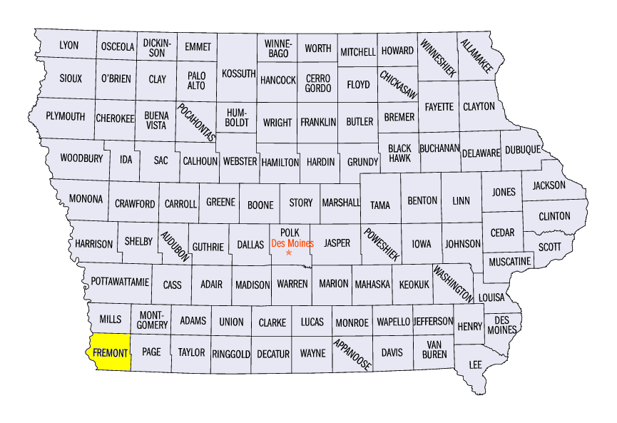
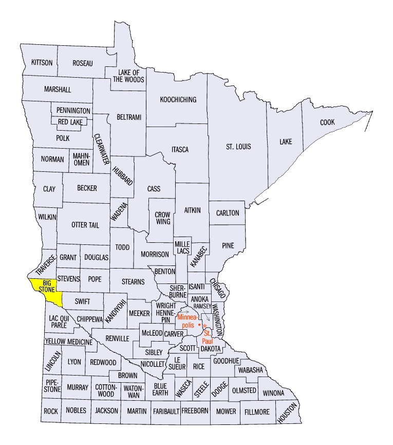
October 11 Strong Storms
A storm system impacted western Iowa and western Minnesota on October 11, causing wind damage and large hail (Figure 10). Wind gusts over 60 mph were recorded in southwestern Iowa, with a 67-mph gust recorded near Sidney (Fremont County). Most of the damage from these storms occurred in eastern Nebraska before moving east into Iowa. Hail 2.5 inches in diameter was also reported near Ortonville, MN (Big Stone County). Winds also knocked down power poles and trees in western Minnesota.
-BJP-