August 11-17, 2020
Midwest Weekly Highlights - August 11-17, 2020
Slightly Warmer
Temperatures across the Midwest were largely near- to slight above normal for the week
(Figure 1). Only a few areas in eastern Ohio and Michigan were more than 2°F above normal. Most of Illinois, Missouri, southern Wisconsin and eastern Iowa were near normal, with the only area below normal in central Minnesota.
Heavy Rain in Minnesota
Moderate to heavy rain fell across Minnesota during the week (Figure 2), leading to 1-3 inches across most areas. Heavier amounts fell in central Minnesota, with more than four inches. Most of this precipitation fell from storms through the mornings of August 14
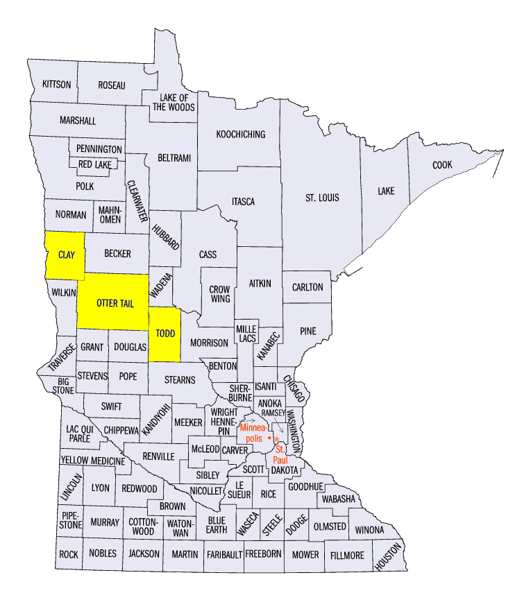
(Figure 3) and August 15 (Figure 4). Weekly totals in Minnesota included 6.04 inches in Long Prairie (Todd County). 5.37 inches in Ottertail (Otter Tail County) and 5.25 inches in Pelican Rapids (Otter Tail County). Many areas in Minnesota had 2-5 times the normal amount for the week
(Figure 5). Areas in the Ohio River Valley were also wet during the period, with some areas receiving more than twice the normal amount. More than 80 daily precipitation records were broken across the region (Figure 6). However, many areas throughout the region were very dry, with some areas of Iowa, Michigan and Wisconsin had less than a quarter of the normal amount.
Derecho Impacts Continue
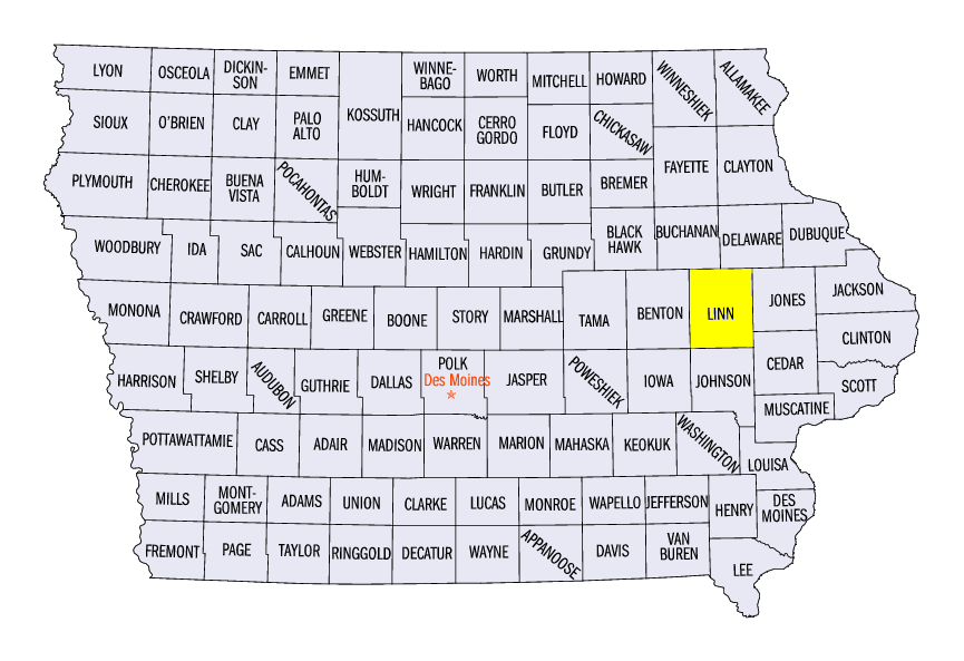
The derecho on August 10 continued to lead to impacts across Iowa throughout the week. Power outages remained widespread in central Iowa days after the storm, with tens of thousands still without power in the Cedar Rapids, IA (Linn County) area at the end of the week. Many utility repair trucks were dispatched to the east coast due to power outages from Hurricane Isaias, which caused delays in repairs in Iowa. An estimated 90 percent of structures in Cedar Rapids sustained some sort of damage, with more than 1,000 homes reported as destroyed.
August 14 Minnesota Severe Weather
An outbreak of severe weather in northern Minnesota led to more than 80 reports of strong winds, hail and tornadoes on August 14
(Figure 7). Five tornadoes were reported in Grant County, MN alone, with more than a half dozen others reported from central Minnesota through the Twin Cities suburbs. Strong winds between 50-70 mph were reported in northern Minnesota, including an 85-mph gust in Felton, MN (Clay County). A large grain bin was crushed at a grain elevator complex. Numerous trees were felled along with power lines.
Drought Recedes in Michigan
Drought coverage decreased in eastern Lower Michigan according to the August 11 U.S. Drought Monitor (Figure 8). Wetter weather over the past few weeks contributed to the removal of drought. However, most of the region remained in similar condition to the previous week, with western Iowa in extreme drought.
-BJP-