July 15-21, 2020
Midwest Weekly Highlights - July 15-21, 2020
Some Lingering Heat
Temperatures moderated slightly in the Midwest after a hot first half of July
(Figure 1). Most of the Upper Midwest was within a degree of normal, with a few areas slightly below normal. The Ohio River Valley and southern Missouri remained warmer than normal, however. Some areas in eastern Ohio and Kentucky were 4-5°F above normal.
Heavy Rains
Thunderstorms tracked across the Upper Midwest as well as across northern Missouri and central Illinois in an active week (Figure 2). More than an inch of rain fell across Wisconsin, Michigan, Illinois, northern Minnesota and northern Missouri, with some areas receiving upwards of three inches. Clusters of storms dumped heavy rain on July 15
(Figure 3), July 16 (Figure 4), July 18
(Figure 5), July 19 (Figure 6) and July 20
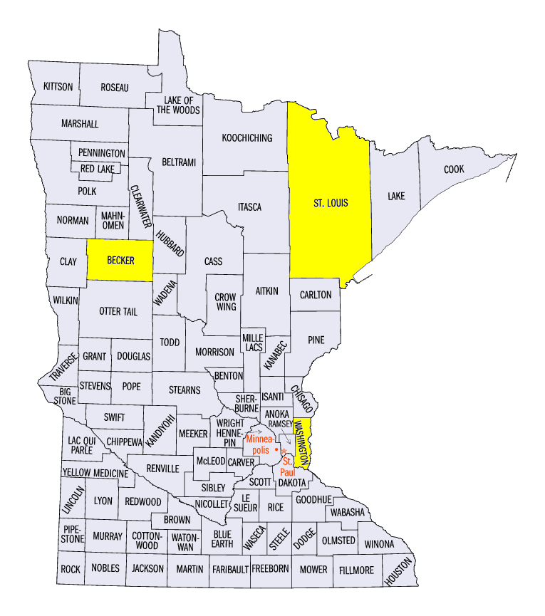
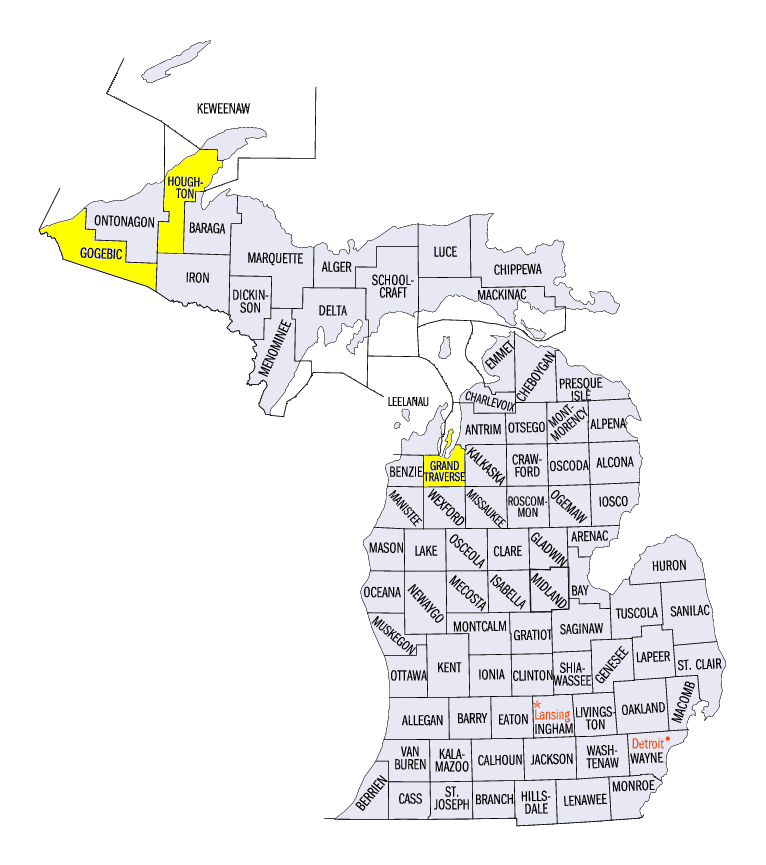
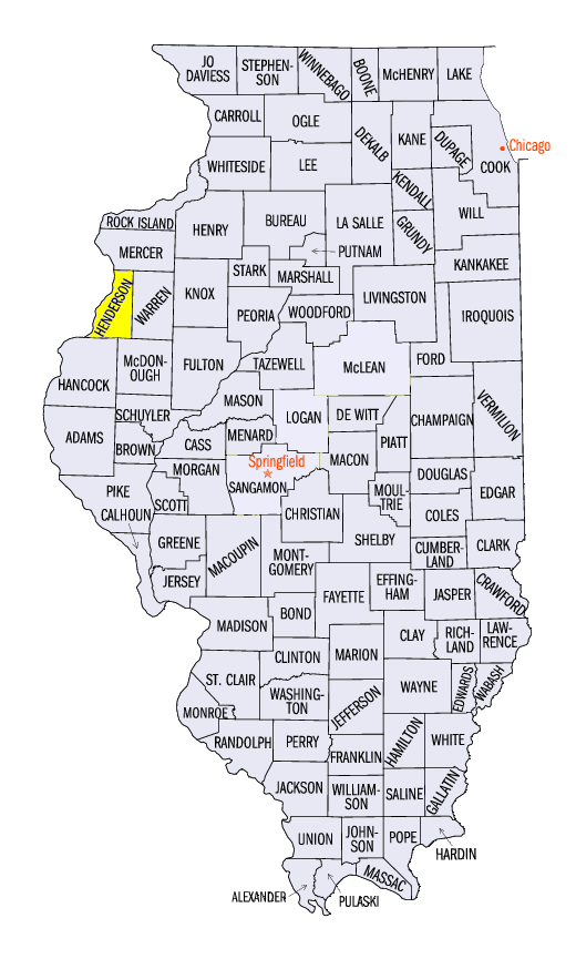
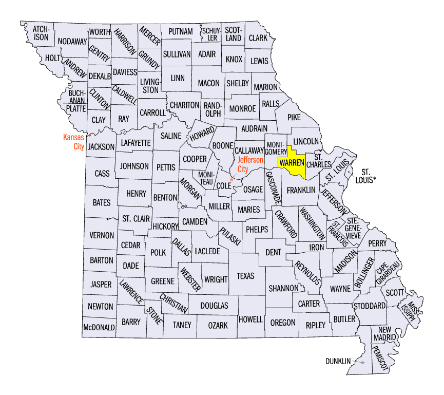
(Figure 7). Some of the totals across the region included 5.42 inches near Detroit Lakes, MN (Becker County), 5.13 inches near Traverse City, MI (Grand Traverse County), 8.65 inches in Roanoke, IL (Woodford County) and 10.05 inches near Warrenton, MO (Warren County). A total of 9.00 inches fell through the morning of July 19th alone in Warrenton. More than 125 daily precipitation records were broken across the Midwest during the week (Figure 8). Meanwhile, drier weather continued in some areas, including northwestern Iowa and the eastern Ohio River Valley. These areas received less than half the normal amount for the period
(Figure 9).
Active Severe Weather Continues
July severe weather continued to be very active across the Midwest during the week, with more than 500 reports (Figure 10). More than 475 of these reports were from strong winds, with reports on every day of the period. Highlights from the week included several tornadoes in Wisconsin, Minnesota and Illinois, including an EF-1 tornado near Hastings, MN (Washington County) on July 18
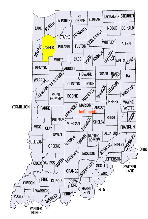
(Figure 11). Storms in northern Michigan, northern Wisconsin and northern Minnesota also resulted in very large hail and strong winds on July 18, including 3-inch hail near Shaw, MN (St. Louis County) and a 95 mph wind gust near Nisula, MI (Houghton County). A man was also injured when a tree fell on his car near Marenisco, MI (Gogebic County). Winds on July 19 impacted Illinois through Ohio (Figure 12), with an 84 mph wind gust near Rozetta, IL (Henderson County) and an 86 mph gust near Bailey’s Corner, IN (Jasper County). Strong winds also impacted central Illinois through Indiana to end the week on July 21
(Figure 13).
Drought Expands in Western Iowa
Drier weather once again contributed to an expansion of drought across western Iowa according to the July 21 U.S. Drought Monitor (Figure 14). More than a quarter of the state was considering in either moderate or severe drought. Moderate drought also expanded in areas of Indiana and Ohio and was introduced into eastern Lower Michigan. However, some improvement was made during the week as well, with severe drought coverage dropping slightly in northeastern Minnesota. More than five million people were estimated to be living in drought-affected areas in the region.
-BJP-