July 8-14, 2020
Midwest Weekly Highlights - July 8-14, 2020
Heat Remains
While not as warm as the first week of July, heat remained widespread in the Midwest during the period
(Figure 1). Average temperatures were 1-3°F above normal for many areas of the region. Some areas of west-central Minnesota, eastern Illinois, western Indiana and Kentucky were near normal, however. Maximum temperatures averaged in the upper 80s to low 90s across the southern two-thirds of the region (Figure 2). In total, more than 50 daily high temperature records were broken across the region
(Figure 3).
Thunderstorms in the Upper Midwest
Thunderstorms brought moderate to heavy rain to the Upper Midwest during the week (Figure 4). Areas in southern Wisconsin were the wettest, with some areas receiving more than three inches. Most of this rain fell through the mornings of July 9
(Figure 5) and July 10 (Figure 6). Some of the heaviest amounts for the week included 6.89 inches near Lebanon, WI (Dodge County) and 5.39 inches near Rhinelander, WI (Oneida County). More than 100 daily precipitation records were broken across the region
(Figure 7). Meanwhile, very dry conditions took over across Missouri and southern Iowa, with most areas receiving less than a quarter of the normal amount (Figure 8).
Widespread Severe Weather
Reports of strong winds, hail and several tornadoes were reported throughout the Midwest during the week
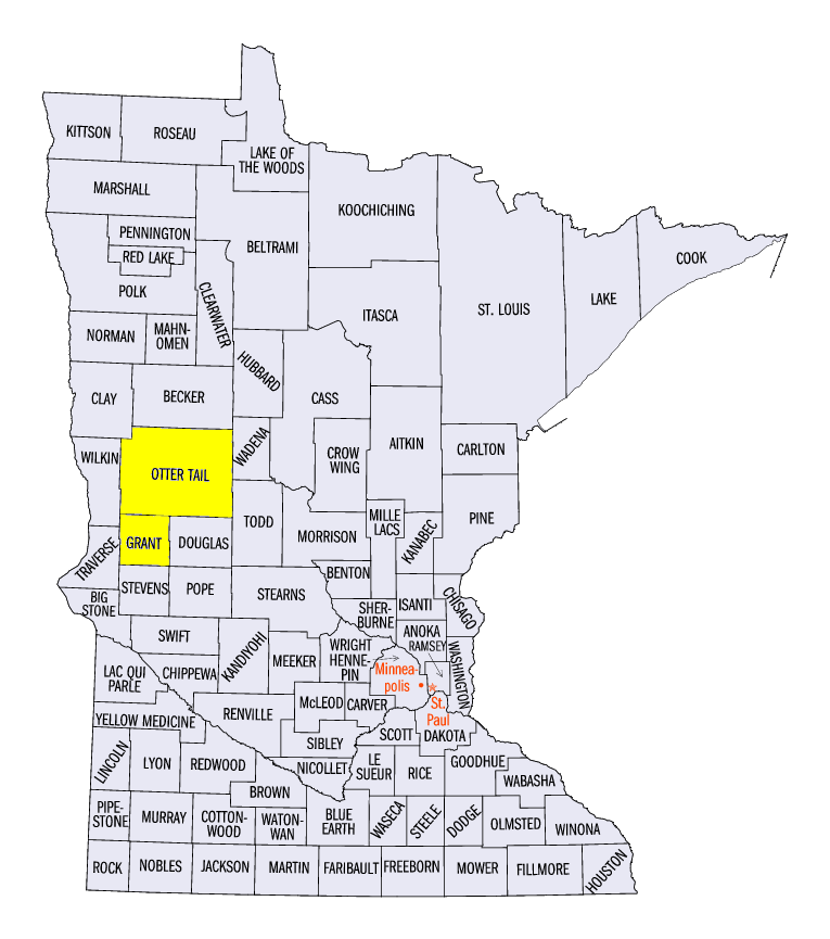
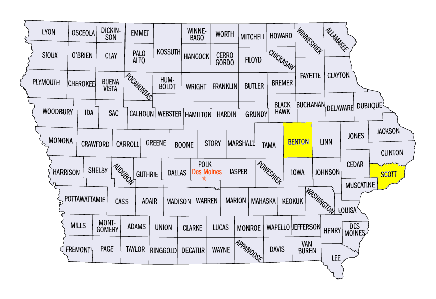
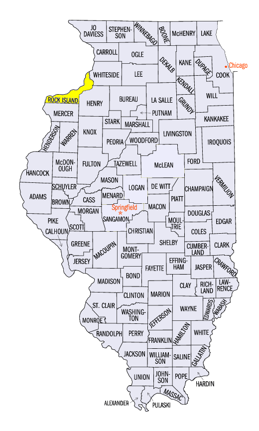
(Figure 9). Each day in the period had severe weather reports. Several tornadoes were reported on July 8 in northern Minnesota (Figure 10), with a powerful EF-4 tornado with estimated wind speeds of 170 mph impacting Grant and Otter Tail counties. A 30-year old man was killed from the tornado while two others were injured, and other structures were toppled in the rural counties. Strong storms also formed from southern Minnesota through Iowa, Illinois and Indiana on July 11
(Figure 11), leading to more than 300 storm reports. Large hail of two or more inches in diameter was reported in Iowa, including a 3-inch diameter report near Norway, IA (Benton County). Hail also caused damage across central Illinois and southern Minnesota. Strong winds reached 60-70 mph in many areas along the line, with a 90-mph gust near Mount Joy, IA (Scott County) and an 80-mph at the Quad Cities Airport near Moline, IL (Rock Island County). In total, more than 640 reports were tallied across the Midwest during the week.
Drought Worsens in Iowa and Minnesota
Areas of drought were introduced in west-central Iowa while expanding in northern Minnesota according to the July 14 U.S. Drought Monitor (Figure 12). Spotty areas of moderate drought were also added to areas in northern Indiana and Ohio, with a larger area in southeastern Illinois through southwestern Indiana. Abnormally dry conditions also expanded across Missouri and Lower Michigan, with drier recent weather a contributing factor, along with soil types and critical pollination times for corn and soybeans.
-BJP-