June 10-16, 2020
Midwest Weekly Highlights - June 10-16, 2020
Sharp Temperature Divide
Temperatures were divided across the region with the eastern two-thirds of the region colder than normal and western Minnesota, Iowa and Missouri warmer than normal
(Figure 1). Areas in Michigan and eastern Wisconsin were 3-5°F below normal, while Illinois, Indiana, Ohio and Kentucky were 1-3°F below normal. A sharp difference in temperatures was noted along the western edge of the region, with parts of southwestern Minnesota more than 4°F above normal. Dozens of both high (Figure 2) and low
(Figure 3) daily temperature records were scattered across the region.
Very Dry Week
The remnants of Tropical Storm Cristobal led to the only major source of precipitation for a very dry week across the Midwest (Figure 4). From June 12-16, very little precipitation fell in the region
(Figure 5). However, precipitation amounts over an inch were recorded through June 11 in eastern Iowa, Wisconsin and Michigan. Rainfall during these days led to amounts more than twice the normal amount for the full period (Figure 6).
Abnormally Dry Conditions Expand
Abnormally dry conditions expanded across the Midwest according to the June 16 U.S. Drought Monitor
(Figure 7). More than 70 percent of Indiana was considered abnormally dry, compared to zero percent on June 9. Moisture deficits had been increasing across the state over the past few weeks according to the Drought Summary. Meanwhile, moderate drought slightly expanded in Minnesota, as low humidity and high winds were cited as increasing issues beyond precipitation.
June 10 Ohio Valley Severe Weather
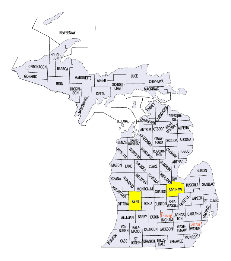
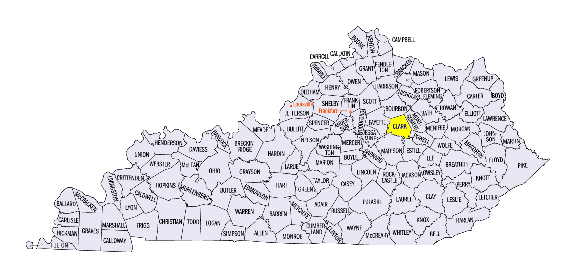
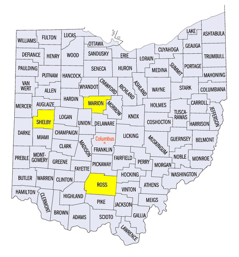
As Cristobal moved out the Midwest, a cold front formed in the Ohio River Valley and Michigan, causing widespread severe thunderstorm winds (Figure 8). More than 475 reports of severe winds were submitted, with some wind gusts over 70 mph. Reported gusts included 75 mph near Grandville, MI (Kent County), 77 mph near Winchester, KY (Clark County) and 80 mph in Converse, IN (Miami County). An injury was reported near Saginaw, MI (Saginaw County) as a tree fell on their car, while two were injured in Goblesville, IN (Huntington County) when a golf course shelter was destroyed. An injury was also reported in Marion, OH (Marion County) from an 80-mph wind gust, and another in Shelby County, OH, at a campsite. Several weak tornadoes were also reported, including an EF-0 surveyed near Chillicothe, OH (Ross County).
-BJP-