May 18-24, 2020
Midwest Weekly Highlights - May 18-24, 2020
Warm in the Upper Midwest
Temperatures were warmer than normal across the Upper Midwest and Great Lakes during the period
(Figure 1). Portions of northern Minnesota, and the U.P. of Michigan were as much as 8°F above normal, while Lower Michigan, Wisconsin and southern Minnesota were 1-5°F above normal. The remainder of the region was mostly within 2°F of normal. Differences were noted in the southern half of the region however, as maximum temperatures were cooler than normal (Figure 2), while minimum temperatures were warmer
(Figure 3).
Heavy Rain to the East
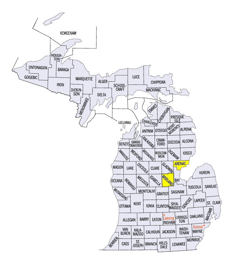
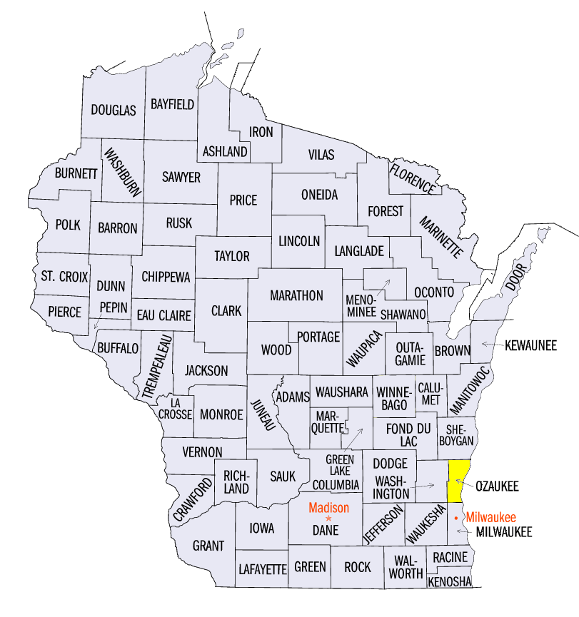
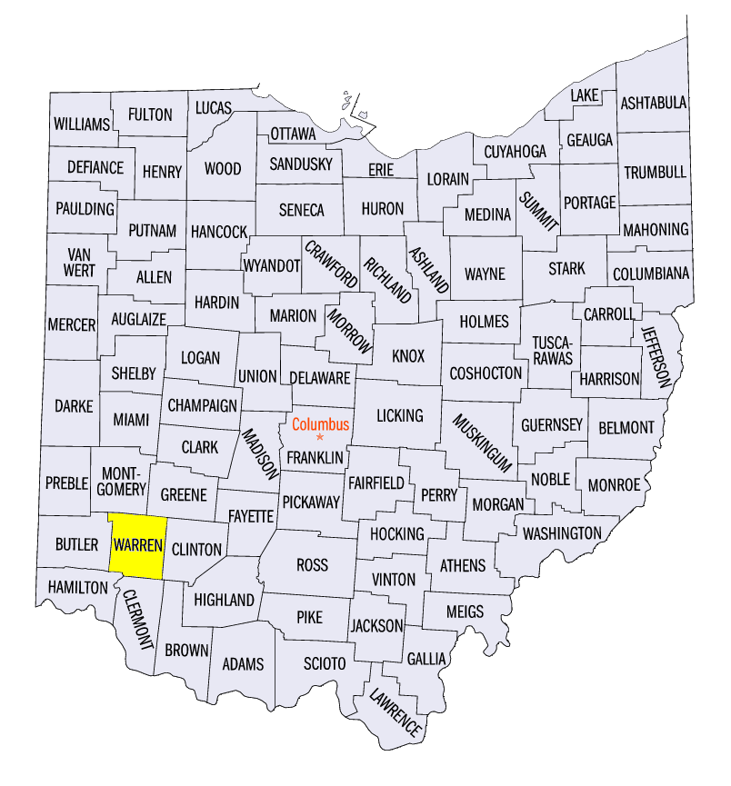
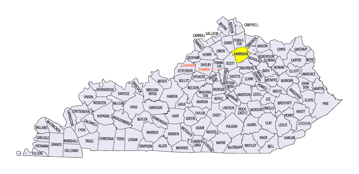
Heavy rainfall impacted the eastern half of the Midwest during the week (Figure 4). Rainfall amounts of 2-4 inches were common in eastern Wisconsin, Indiana, Michigan, Ohio and eastern Kentucky. Most of this rainfall fell through the mornings of May 18
(Figure 5) and May 19 (Figure 6). Some of the heaviest amounts included 6.93 inches near Standish, MI (Arenac County), 7.25 inches near Belgium, WI (Ozaukee County), 5.84 inches in Kings Mills, OH (Warren County) and 6.28 inche near Cynthiana, KY (Harrison County). Meanwhile, drier conditions were common across most of Minnesota, Iowa, Missouri and western Illinois. Most of these areas had less than 75 percent of normal
(Figure 7), with northern Minnesota and the U.P. of Michigan receiving little to no precipitaiton for the period.
Midland, MI Dam Breach
Very heavy rainfall in Lower Michigan on May 17-19 led to a dire emergency in Midland, MI (Midland County) as the Edenville Dam upstream was breached. After the dam breach, water overflowed the downstream Sanford Dam and led to record flooding on the Tittabawassee River (Figure 8). A crest of over 35 feet was recorded, compared to the old record of 33.9 feet. An immediate evacuation of around 11,000 residents happened in less than just 12 hours according to the city, with no loss of life or major injury. The DOW chemical company in Midland activated emergency operations to keep contaminents from entering the floodwaters. A federal emergency declaration was approved on May 21 to assist with the clean-up.
May 23-24 Severe Weather
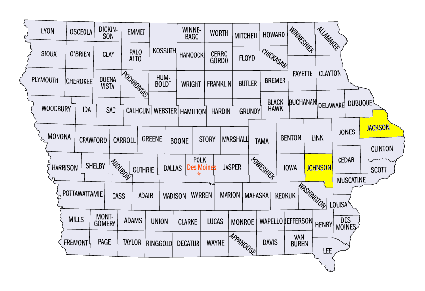
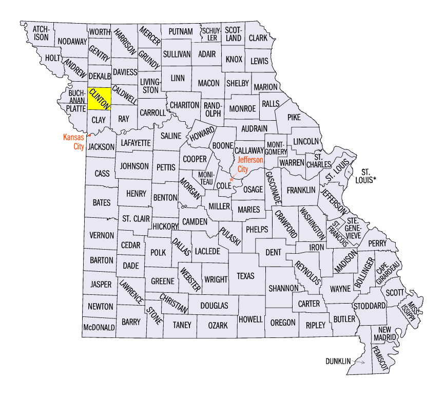
Severe weather was mainly limited across the Midwest except for May 23-24. Strong thunderstorms led to tornadoes from eastern Iowa through southern Wisconsin and northern Illinois on May 23 (Figure 9). These included an EF-1 tornado near Morse, IA (Johnson County) and an EF-0 near Mequoketa, IA (Jackson County). At least half a dozen more weak tornadoes were reported. On May 24, thunderstorms across northern Missouri caused strong winds and hail (Figure 10). A 2.75 inch diameter hailstone was reported near Gower, MO (Clinton County) with wind gusts of up to 60 mph recorded.
Abnormally Dry Conditions Expand
Continued dry weather in Minnesota, Iowa and southwestern Wisconsin contributed to an expansion of abnormally dry conditions according to the May 19 U.S. Drought Monitor
(Figure 11). Abnormally dry conditions covered more than half of Minnesota and more than a quarter of Iowa. However, the Midwest continued to stay drought free for another week.
-BJP-