May 11-17, 2020
Midwest Weekly Highlights - May 11-17, 2020
Cold Continues
Temperatures remained well below normal across the Midwest during the week
(Figure 1). Areas in Michigan were the coldest, with average temperatures 5-8°F below normal. Most of Wisconsin, Minnesota, Iowa and southern Missouri were also 4-6°F below normal. Maximum temperatures were even colder in Michigan and southern Missouri, with areas 8-9°F below normal (Figure 2). Most of the cold occurred during the beginning of the period, with widespread freezing temperatures in the Upper Midwest through the mornings of May 11
(Figure 3), May 12 (Figure 4) and May 13
(Figure 5). More than 500 daily low maximum and minimum temperatures were recorded during the week (Figure 6), with most of these records occurring on May 11
(Figure 7) and May 12 (Figure 8).
Storms from Missouri Through Michigan
Storm tracks during the period followed a track from Missouri through southern Lower Michigan during the week, leaving most of the Ohio River Valley, northern Minnesota and northern Wisconsin very dry
(Figure 9). Amounts in southern Missouri and northeastern Illinois topped 3 inches, with locally heavier amounts over four inches. Rainfall in these areas was more than three times the normal amount (Figure 10). Areas in west-central Illinois, southern Minnesota and southern Lower Michigan also received more than twice the normal amount. Some of the heaviest rainfall was observed through the morning of May 15
(Figure 11), where isolated in northern Missouri, northern Illinois and southern Iowa had more than three inches. Heavy rain led to more than 150 daily precipitation record during the period(Figure 12). Meanwhile, eastern Kentucky, southern Ohio, northern Wisconsin and northern Minnesota had less than half the normal amount for the period. Abnormally dry conditions expanded in part to the increased dryness observed in northern Minnesota according to the May 14 U.S. Drought Monitor
(Figure 13). However, the Midwest remained drought free.
May 14 and May 17 Severe Weather
Severe thunderstorms were limited during the period but produced strong winds on May 14 (Figure 14) and several tornadoes on May 17
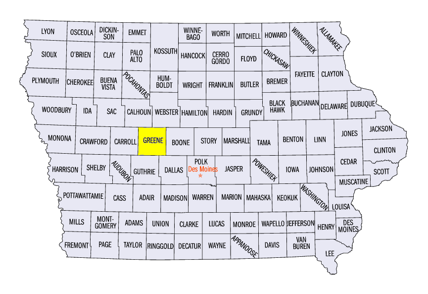
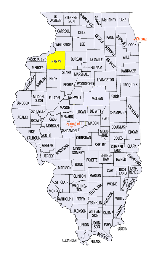
(Figure 15). Wind gusts between 60-70 mph were reported in Iowa, northern Illinois and Ohio on May 14. Hail was also reported in south-central Iowa, where a 2-inch diameter hailstone was measured near Galloway, IA (Greene County). An EF-0 tornado was also reported near Cambridge, IL (Henry County) that produced minor damage to outbuildings. On May 17, several reports of tornadoes were reported in northeastern Illinois and central Illinois. No major damage was reported as these tornadoes occurred in rural areas.
Planting Season Ahead of Schedule
Opportunistic farmers in the Midwest have been planting well ahead of schedule in many states. Corn planting progress is near or ahead of the five-year average in all nine Midwest states according to the May 17 USDA NASS Crop Progress Report (Figure 16). Minnesota and Iowa are 95 and 96 percent planted respectively, while Missouri, Wisconsin and Illinois were all more than 80 percent planted. Soybeans were also ahead of schedule
(Figure 17), with every Midwest state except Missouri 15 or more percent ahead of the five-year average. Iowa soybeans were at 86 percent planted, with was 41 percent ahead of the five-year average.
-BJP-