April 1-7, 2020
Midwest Weekly Highlights - April 1-7, 2020
Warmth Continues into April
Warmer than normal temperatures continued into the first week of April across the Midwest
(Figure 1). Average temperatures were 1-3°F above normal across most of the region, with only a few areas in the western Midwest near normal. Only northwestern Minnesota had temperatures below normal. Maximum temperatures were a major contributor to the above-normal average temperatures, with areas in Wisconsin, Michigan and Kentucky as much as 7°F above normal (Figure 2). Average maximum temperatures were in the 60s across the southern Midwest
(Figure 3). However, less than two-dozen daily high temperature records were broken across the Midwest (Figure 4).
Drying Out
After a wet March, drier conditions took over for the first week of April
(Figure 5). Only a few areas in northwestern Minnesota recorded more than an inch of precipitation for the period. Most of Illinois and the western Ohio River Valley recorded less than a tenth of an inch, which was less than a quarter of normal (Figure 6). Areas in northern Minnesota, however, had more than twice the normal amount. Some of that precipitation was due to snowfall through the mornings of April 3
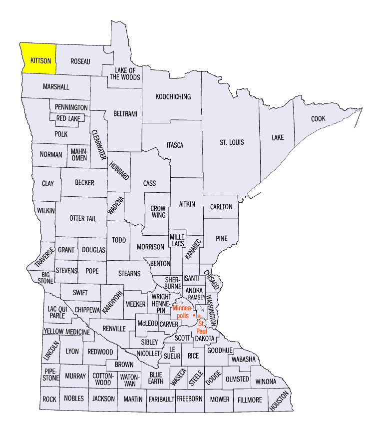
(Figure 7) and April 4 (Figure 8). Amounts of over 8 inches were recorded, including 12.0 inches at the Bronson Dam (Kittson County).
April 7-8 Severe Weather Outbreak
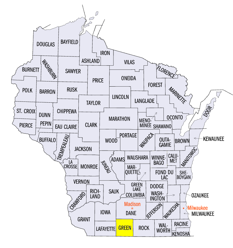
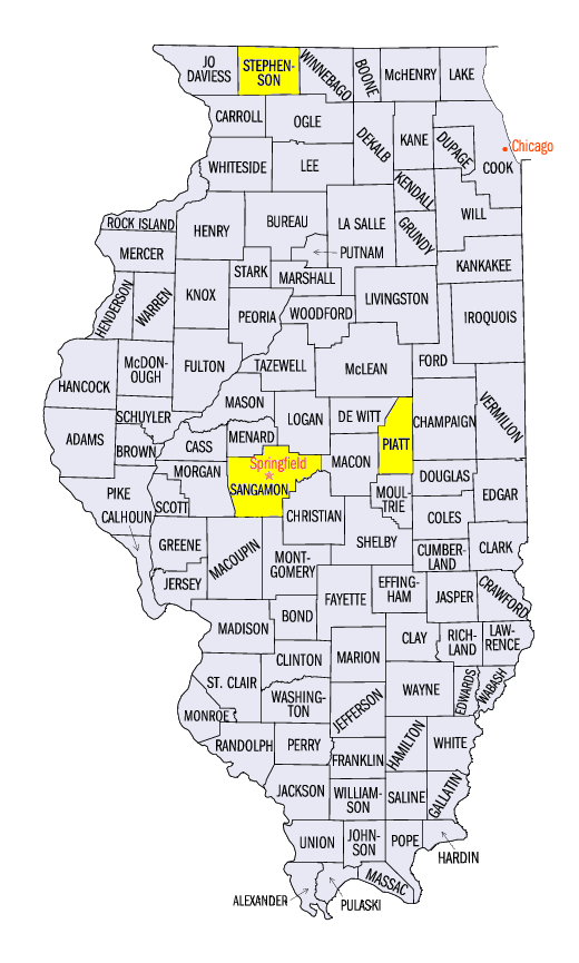
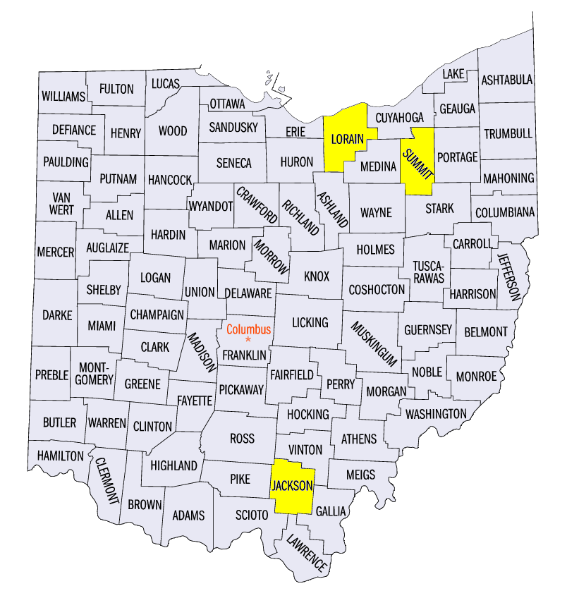
A powerful storm system impacted the Midwest on April 7-8, leading to severe winds and large hail. On April 7, the system impacted areas of Wisconsin, eastern Iowa, Michigan, northern Illinois and western Ohio with large hail while strong winds and tornadoes were reported in Ohio (Figure 9). Multiple reports of 2-inch diameter hail were reported in southern Wisconsin, eastern Iowa and northern Illinois. This included 3-inch reports near Browntown, WI (Green County) and Rock Grove, IL (Stephenson County). Several EF-1 tornadoes were reported near Barberton, OH (Summit County) and Grafton, OH (Lorain County), along with several other weak EF-0 tornadoes in Ohio.
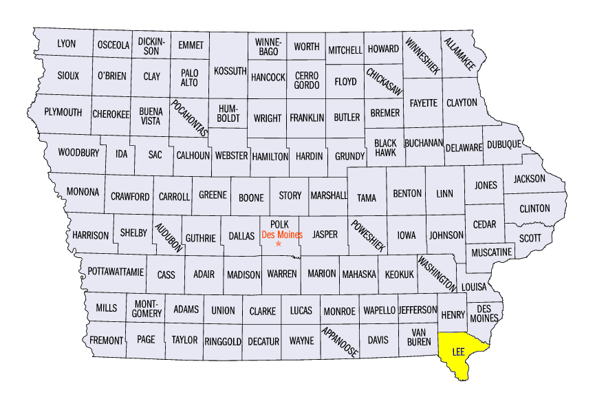
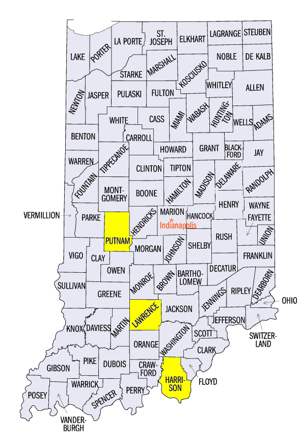
Strong thunderstorms continued through April 8 from western Illinois through the Ohio River Valley (Figure 10). Strong winds were the main cause of impacts, with some hail reported along with several weak tornadoes in Indiana. Softball sized hail was reported near Denmark, IA (Lee County). Other large hail reports included 3 inches near Sherman, IL (Sangamon County), 2.5 inches near Oak Hill, OH (Jackson County) and 2.25 inches near Sikeston, MO (Scott County). Wind gusts exceeding 60 mph were common across east-central Illinois, southern Indiana and eastern Kentucky. Some of the strongest gusts included 76 mph near Milltown, IN (Harrison County), 77 mph near Silverville, IN (Lawrence County), 76 mph near Greencastle, IN (Putnam County) and 80 mph near Bement, IL (Piatt County). Large trees and power poles were felled. Power outages were reported in east-central Illinois and southern Indiana overnight on April 8 as winds affected a large area.
-BJP-