March 25-31, 2020
Midwest Weekly Highlights - March 25-31, 2020
Warm Weather Remains
Temperatures were above normal across most of the Midwest during the final week of March
(Figure 1). Only a few areas along Lake Michigan and in northwestern Minnesota were near normal. Temperatures were the most above normal in southern Missouri and the Ohio River Valley at 6-10°F above normal. Several dozen daily high maximum and minimum temperature records were broken across the southern Midwest as well (Figure 2). Most of the Upper Midwest was 1-3°F above normal.
Heavy Rain in the Upper Midwest
Precipitation amounts of over an inch were widespread across the Upper Midwest during the week
(Figure 3). A large amount of this rainfall fell through the mornings of March 28 (Figure 4) and March 29
(Figure 5) as a storm system moved through the region. Precipitation amounts in the Upper Midwest were 200-300 percent of normal (Figure 6), with some areas in east-central Minnesota recording more than four times the normal amount. More than 150 daily precipitation records were broken across the region
(Figure 7). Some light snow was also recorded in northeastern Minnesota through the morning of March 29 (Figure 8). Meanwhile, drier conditions were recorded across southern Iowa, northern Missouri and parts of the Ohio River Valley. Northwestern Minnesota recorded little to no precipitation for the week.
March 26-28 Severe Weather
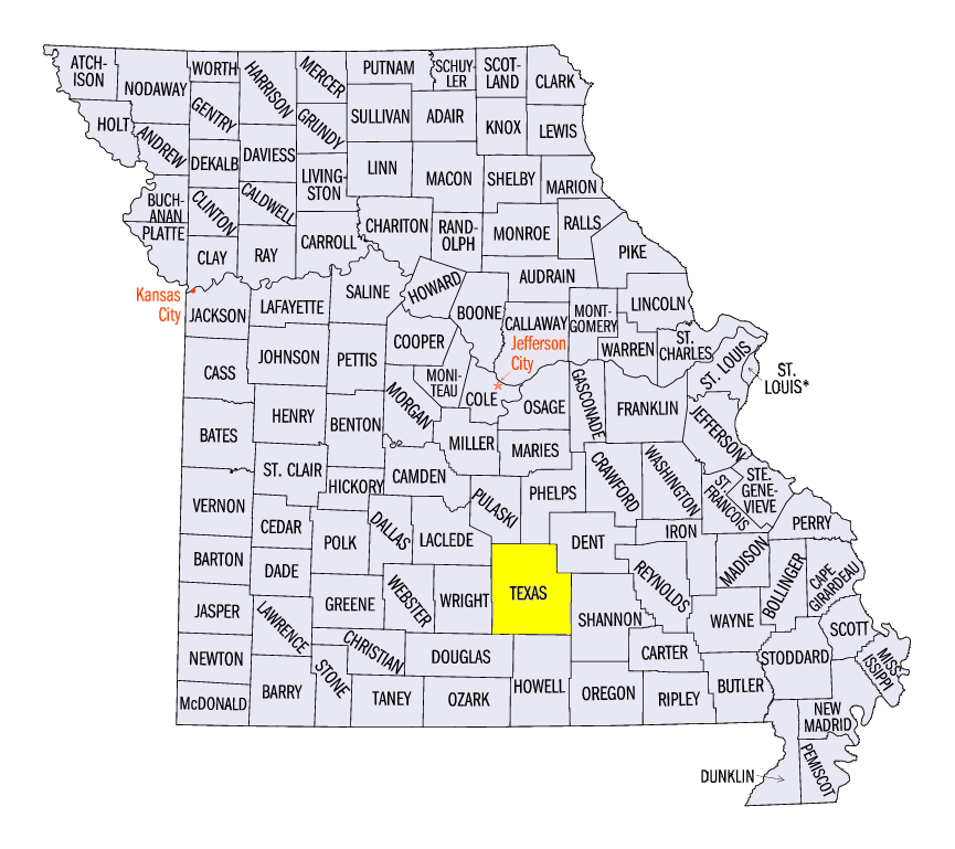
The first major severe storm event for the Midwest in 2020 impacted Missouri, Iowa, southern Wisconsin, Illinois and the Ohio River Valley from March 26-28 (Figure 9). A long-track storm dropped hail along a line from the Kansas City area to the St. Louis area on March 26. Hail returned to Missouri on March 27, with many reports of large hail more than 2 inches in diameter. The largest of these hailstones was recorded at 4.5 inches near Houston, MO (Texas County).
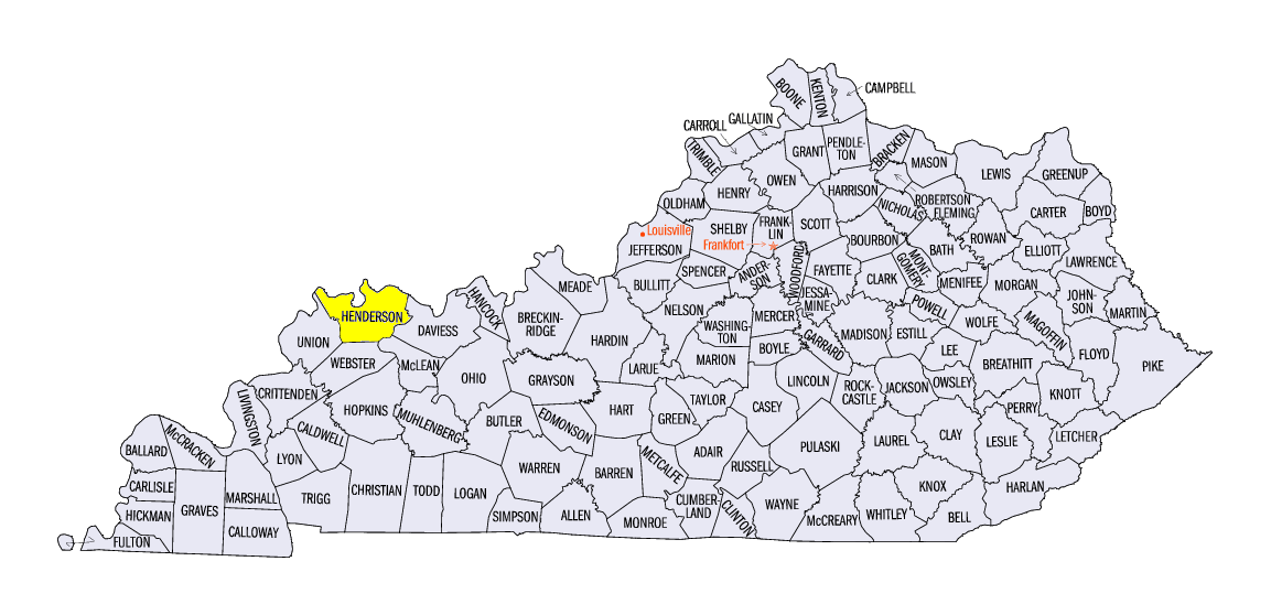
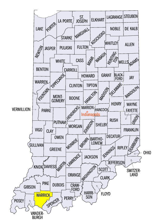
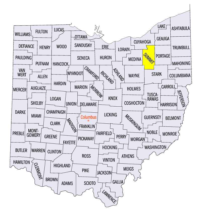
The main severe weather event was on March 28 across the region. Tornadoes were observed in Iowa, Wisconsin, Illinois and southern Indiana, with reports of large hail and damaging winds across the region. An EF-2 tornado was surveyed near Corydon, KY (Henderson County) while several other EF-1 tornadoes were reported. Two injuries were reported from a tornado in Newburgh, IN (Warrick County). Numerous farm outbuildings and trees were damaged in these tornadoes. Strong winds and large hail were also reported, including 2.5-inch diameter hail near Akron, OH (Summit County) and a 90-mph wind gust near Spottsville, KY (Henderson County).
Flooding Continues
Minor to moderate flooding continued along the Mississippi River during the week (Figure 10). Heavy rainfall kept river stages from falling and led to higher values along the Iowa and Illinois border. Heavy rain in the northern Ohio River Valley also kept waters on the Wabash River above flood stage, as well as areas of the Ohio River downstream.
Drought-Free Period Continues
The Midwest remained drought free for the 21st consecutive week according to the March 31st U.S. Drought Monitor (Figure 11). The streak for consecutive weeks with no abnormally dry conditions also extended to 12 weeks. Since January 1, 2019, drought-free conditions were recorded for 53 of 66 weeks.
-BJP-