March 11-17, 2020
Midwest Weekly Highlights - March 11-17, 2020
Variable Temperatures
Temperatures were mostly near to slightly above normal across the Midwest for the week
(Figure 1). Significant differences between maximum and minimum temperatures were observed across the Midwest during the period. Maximum temperatures were as much as 6°F below normal in Missouri (Figure 2) while minimum temperatures were as much as 10°F above normal in southeastern Kentucky
(Figure 3).
Wet Across the Southern Midwest
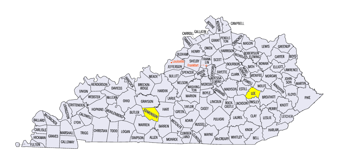
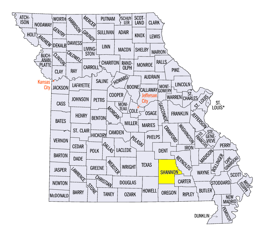
Storms in southern Missouri and Kentucky brought heavy rain on several days during the week (Figure 4). Totals for the period in these areas were 1-3 inches, with locally heavier amounts. This was 2-3 times the normal amount
(Figure 5). Some of the heaviest amounts included 4.37 inches near Beattyville, KY (Lee County), 3.90 inches at Mammoth Cave, KY (Edmonson County) and 3.74 inches near Winona, MO (Shannon County). Most of this rainfall fell through the mornings of March 13 (Figure 6), March 14
(Figure 7) and March 15 (Figure 8). Moderately heavy amounts also fell in northern Wisconsin and the U.P. of Michigan. Some of this precipitation was from snowfall
(Figure 9), with amounts between 1-4 inches in northeastern Wisconsin, the U.P. of Michigan and northern Minnesota. Light snow also fell from western Iowa through Ohio through the mornings of March 14 (Figure 10) and March 15
(Figure 11).
-BJP-