Welcome to the Regional Mesonet Program!
The Regional Mesonet Program (RMP) is a collaboration of multiple states and mesonet groups, where regional maps are created using merged mesonet data. Mesonets are collection of weather stations that gather information about the environment, such as atmospheric, soil, and moisture conditions (see the Midwest State Mesonet Summary Table). Mesonets are often developed to serve a particular audience such as a state’s agricultural community, but the data collected can often be valuable to other groups outside of their target audience.
The MRCC is proud to host daily operational product maps from various mesonet groups around the Midwest region. Currently, the RMP has soil temperature and potential evapotranspiration (PET) maps available.
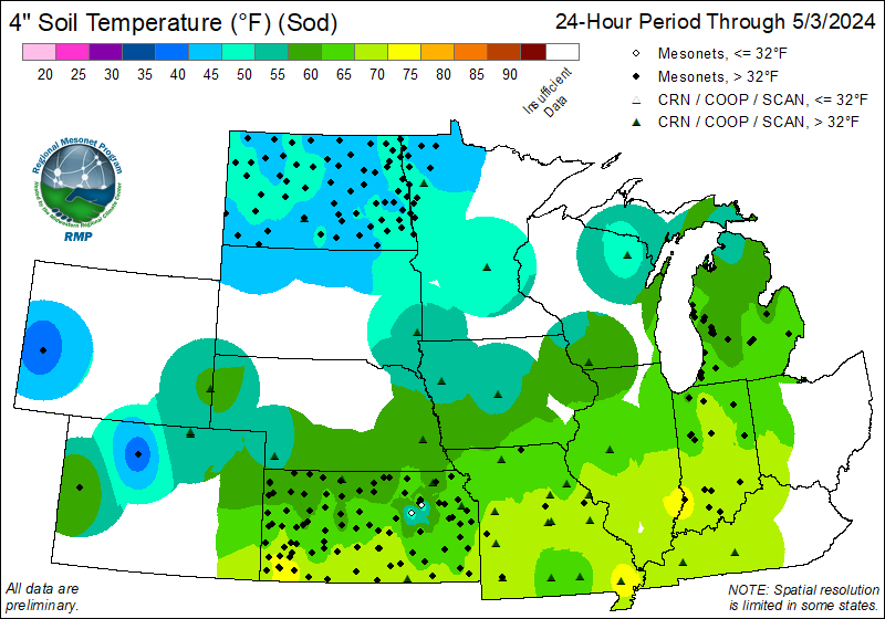
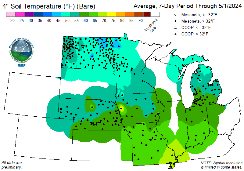
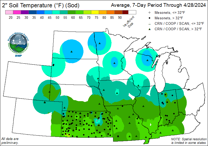
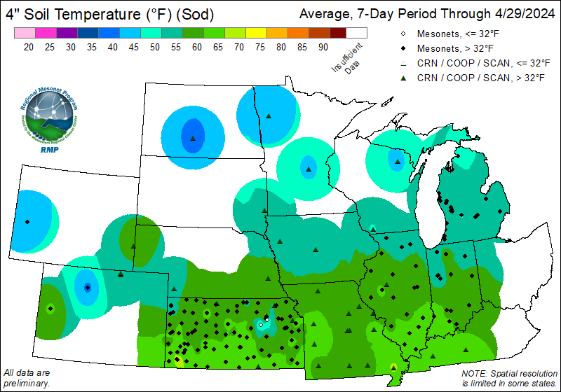
Current Soil Temperature Maps
Access Data Viewer| Period | 2-inch Under Bare Soil | 4-inch Under Bare Soil | 2-inch Under Sod | 4-inch Under Sod |
| 24-Hour | 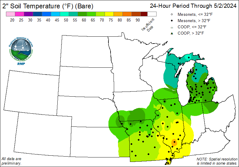 |
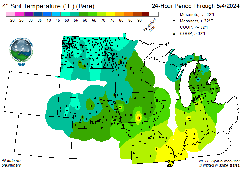 |
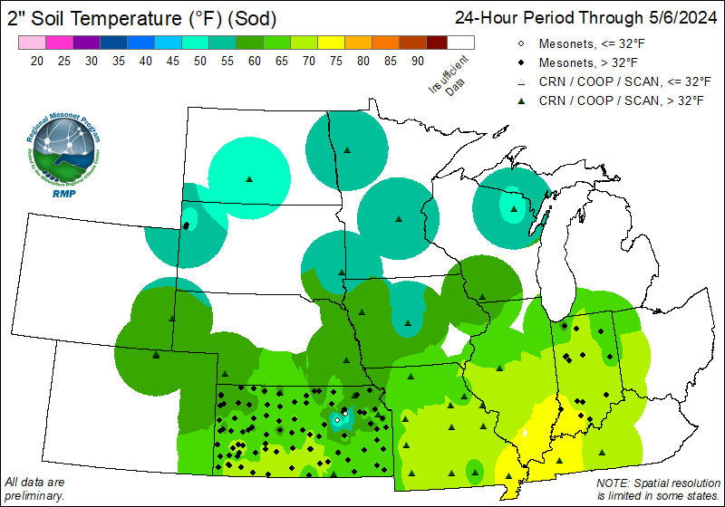 |
 |
| 7-Day | 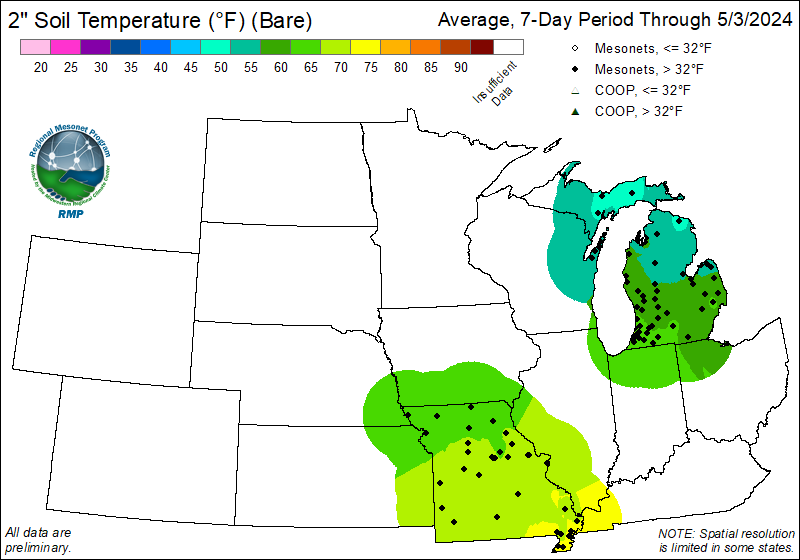 |
 |
 |
 |
Current Potential Evapotranspiration (PET) Maps
Access Data Viewer| 24-Hour | 7-Day |
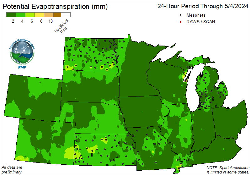 |
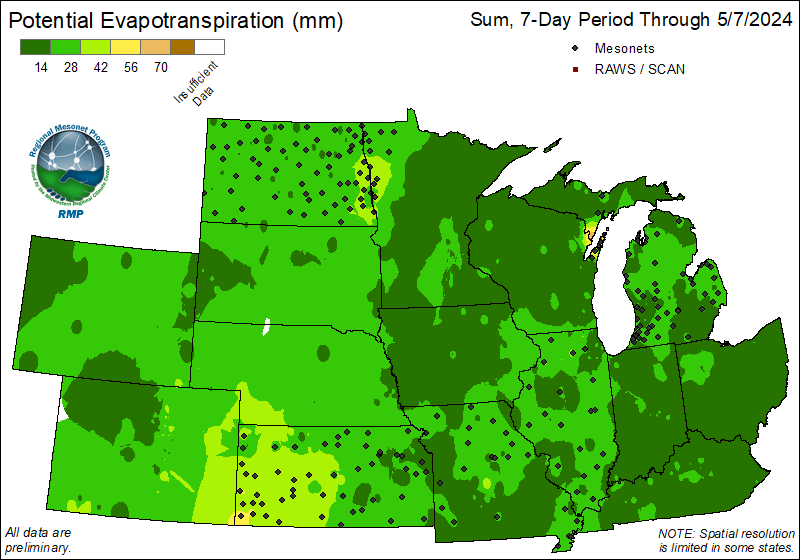 |
Archived RMP Maps

Partners
The mesonet groups that are a part of Regional Mesonet Program (RMP) are from multiple states and mesonet groups. For more information on any of the state or national networks, please visit their websites.
 |
 |
 |
 |
 |
 |
 |
 |
 |
 |
 |
 |
 |
 |
 |