The Great Flood of 1913
100 Years Later

Community Profiles: Shoals, Indiana
| River: | East Fork White |
| Storm Total Rainfall: | 10.41" OR 9.28" |
| Known Fatalities: |
Timeline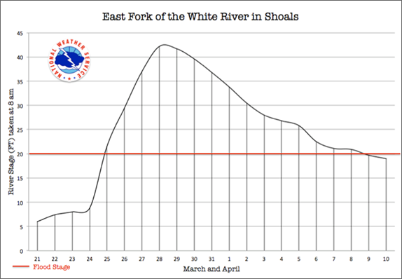
The March 1913 flood is the granddaddy of all the floods along the East Fork White Rivers in Lawrence and Martin Counties. This includes the August 1875, the McKinley (March 1897) and the Great Ohio River (January 1937) Floods. The flood crest of the 1913 flood was several feet higher than any of these great floods.
Shoals received 9.28 inches of rain from March 23rd through March 27th. The greatest rain of 6.66 inches fell on March 25th. (7am to 7am from “A History of the Flood of March, 1913".) The river rose from a low of 6.0 feet on the 21st to 8.0 feet on the 23rd. The morning of the 25th the river leaped above the flood stage of 20 feet and was at 21.6 feet following the deluge of 6.66 inches for the 24 hour period ending at 7 am on the 25th. The river quickly crested 3 days later at a record of 42.2 feet on the 28th. (Source: Daily River Stages 1913.)
Long time river observer at Shoals, Bill Keller, told the story how when his grandfather and a few other river and weather watchers received word that 6.66 inches of rain fell at Shoals by the 25th, they packed up their belongings and headed to higher ground, even though the river was less than 22 feet and they had not received any “official” flood warnings.
Impacts
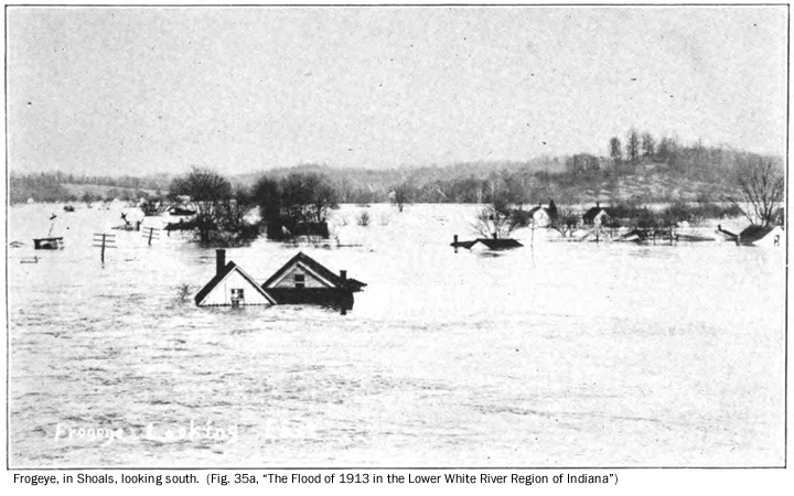
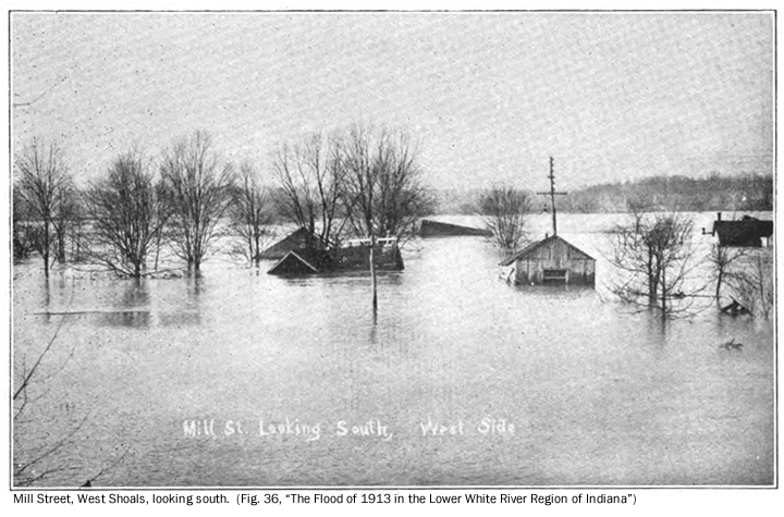
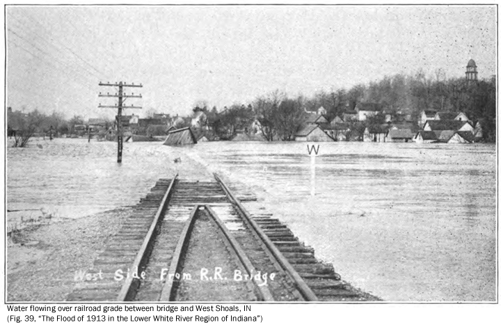
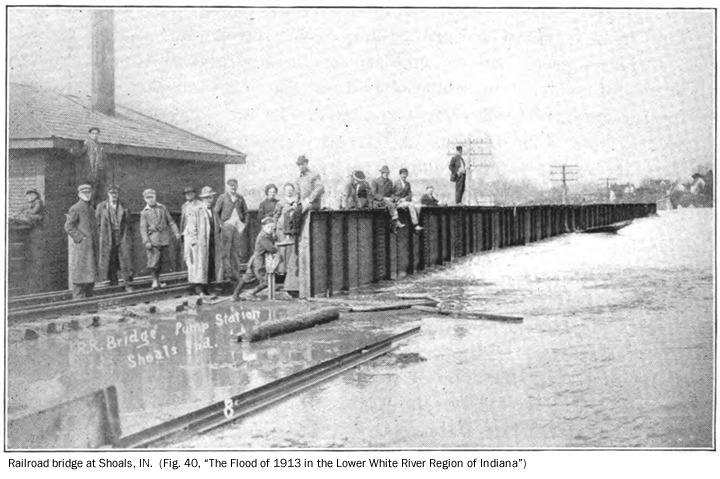
Forty-four houses in Shoals were removed from their foundations or carried away by the March 1913 flood. Judging by the following flood pictures, water was at least a foot deep in homes in the relatively low areas of West Shoals and much higher in “Frogeye”. East Shoals was an island as water was flowing over the railroad bridge connecting East and West Shoals and around the south side of East Shoals. The lower portions of East Shoals were flooded by several feet of water. The total number of people affected in Shoals exceeded 200 and could have been more than 500.
Mr. Keller also related the story of how railroad cars were placed on the tracks immediately west of Shoals to prevent the tracks from washing out. The effort was in vain as flood waters washed out the tracks.
Pictures of Shoals, below, are from “The Flood of 1913 in the Lower White River Region of Indiana” by Hal P. Bybee and Clyde A. Malott. The first image shows "Frogeye," which is the area south of the junction of U.S. Highway 50 and U.S. Highway 150 at Shoals.
Flood Protection Measures
Monroe Lake, a Corps of Engineers reservoir, provides flood control benefits for 9% of the drainage area upstream of Shoals. There are no known levees in the local area.
To add or correct information about the March 1913 flooding at Shoals, e-mail Al Shipe at al.shipe@noaa.gov.