The Great Flood of 1913
100 Years Later

Community Profiles: Muncie, Indiana
| River: | White |
| Storm Total Rainfall: | |
| Known Fatalities: |
Timeline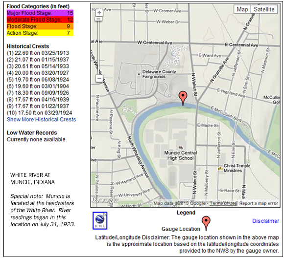
The White River at Muncie was at a typical level for March on the morning of the 23rd. Heavy rainfall of 6 to 8 inches fell in the White River watershed of Muncie from the afternoon of the 23rd through the afternoon of the 26th. Rain changed to snow late on the 26th with accumulations of 1 to 2 inches by the 27th.
The White River rose rapidly on the 24th and by the 25th and by the morning of the 25th was one foot higher than the March 1904 flood. Later in the day, the river crested nearly 20 feet above typical low water.
Impacts
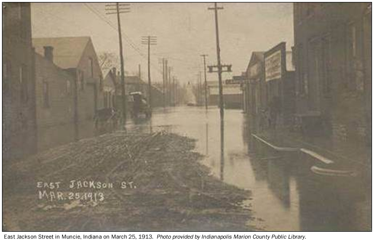
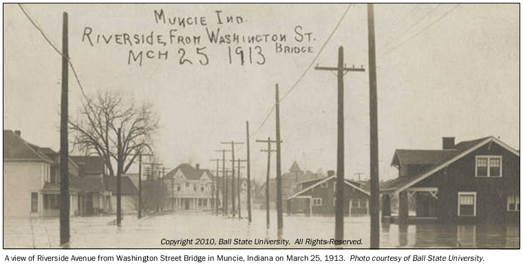
Flood waters overtopped the local levees. High water surrounded 400 homes residences and numerous businesses. All city water service was shut off and railway communications discontinued. Damage occurred to local railroad and highway bridges. The March 1913 flood remains the greatest known flood to strike the Muncie area.
Flood Protection Measures
After the March 1913 flood, the Corps of Engineers did a major modification of the White River channel through the heart of Muncie. The White River channel was widened and better levees constructed. Today a repeat of the March 1913 flood volume would result in a crest about 5 feet lower than experienced in March 1913. This protection is specific to the city of Muncie. Flooding immediately upstream and downstream of Muncie would be disastrous.
To add information about the March 1913 at Muncie, e-mail Al Shipe at al.shipe@noaa.gov.