The Great Flood of 1913
100 Years Later

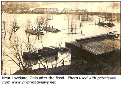
Community Profiles: Loveland and Milford, Ohio
| River: | Little Miami |
| Storm Total Rainfall: | ~7.5" |
| Known Fatalities: | At least 4 in Loveland, Unknown in other communities |
Timeline/Flood History
Below are excerpts from the 1913 U.S. Weather Bureau report ‘The Floods of 1913 in the Rivers of the Ohio and Lower Mississippi Valleys’, also known as ‘Bulletin Z’. This report, as well as US Geological Survey reports after the flood, sought to quantify specific river elevations via survey, as well as estimates of total volume of water in the river.

Little was found regarding historic floods in Loveland or Milford prior to the 1913 flood, with the exception of a mention of major flooding in March of 1897. River forecast points along the Little Miami today include Milford and Perintown on the east fork. While high water marks indicate that the 1913 flood crest at Milford remains the flood of record, the 1913 crest was exceeded during the January 1959 flood along a stretch of the river from near Ft. Ancient to Morrow, and along the East Fork, the 1964 flood near Batavia exceeded that of 1913.
With the Little Miami drainage of roughly 1700 sq mi, the upper half of the drainage has a fairly steep slope to the river channel, but a relatively wide flood plain. In contrast, the lower Little Miami has a somewhat lesser river slope, but the river channel itself can be quite steep in much of the middle and lower basin, with high bluffs on either side of the channel.
Some of the more populous communities today in the Little Miami Basin include Beavercreek Township, Milford and Loveland. Historically, the only river gauges monitored in 1913 was in Oregonia, Ohio, roughly midway through the basin, and Kings Mills, roughly 15 river miles below Oregonia.
Impacts
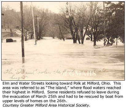
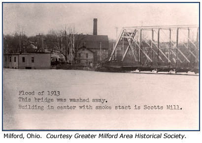
Newspaper reports shared by Milford Historical Society detail the devastation of homes, business and farm buildings by the rapidly rising flood waters. From the headwaters downstream to Terrace Park and near the mouth of the Little Miami at the Ohio, dozens of homes were removed from their foundations with bridges in South Lebanon, Loveland, Miamiville and Milford swept away. Most were able to escape with their lives, only to watch helplessly as their homes were devastated.
 |
 |
In Newtown, the flood waters rapidly destroyed an existing levee, rendering homes inundated to the rooftops. News of the devastation in the upper basin traveled downstream, such that in Milford, volunteers patrolled the river on the night of the 24th. When it was realized that residents of ‘The Island’ within the river’s flood plain would be severe inundated during the morning of the 25th, volunteers worked rapidly to help the residents evacuate their homes.
The lower Little Miami river is also vulnerable to Ohio River backwater, and with the Ohio also rising rapidly during the 26th as the crest was traveling down the Little Miami, these lower communities became a muddy lake of flood waters reaching 10 feet high through homes and businesses.
 |
 |
Flood Protection Measures
The U.S. Army Corps of Engineers completed the Caesar Creek dam in 1965. While not located on the main channel, the control of Caesar Creek Lake would offer some reduction of rises in the lower Little Miami basin. With the lower basin having a steeper channel than the upper, development over time has been further out of the flood plain. However, there are still communities and businesses located within the flood plain. In the event of a 1913 type rainfall with similar existing conditions with Caesar Creek Lake in place, there would still be significant flooding in the Little Miami basin, though substantially less of an areal extent than what was experienced in 1913.