The Great Flood of 1913
100 Years Later
Community Profiles: Fremont, Ohio
| River: | Sandusky |
| Storm Total Rainfall: | 8.67" |
| Known Fatalities: | 3 |
Timeline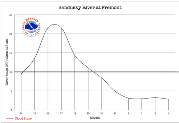
The greatest flood on record, with an estimated recurrence interval of 1,000 years, occurred in March 1913 and is regarded as the historical maximum. Although the flood occurred in March, it was the result of high discharges only and was not caused by ice jams.
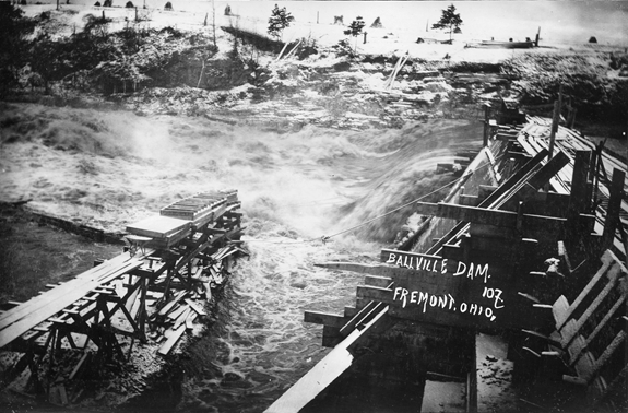
Fremont is located downstream of Tiffin on the Sandusky River. Between the two towns lie a number of dams, the largest being the Ballville Dam located a few miles above Fremont. The force of the flooded Sandusky River caused the south portion of the Ballville Dam to collapse on Tuesday morning, March 25, well before the river even crested. A few witnesses barely escaped the rushing flood waters, but one was able to capture this photograph of the dam failure.
Impacts
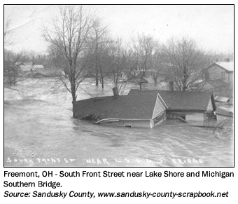
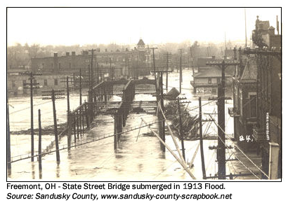
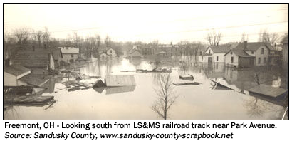
During this flood a majority of the bridges along the Sandusky River were destroyed. An estimated 550 homes were flooded, and 50 were completely destroyed. One estimate lists property damage (including residences, businesses, the Ballville dam, county roads and bridges, etc.) at well over $1 million. Three persons died in the flood, one of them after rescuing hundreds of other people. Over a thousand people were rescued during the flood, mainly on Tuesday Night, when the water rose rapidly as the flood wave arrived from Tiffin. The water was in the first floor of many homes, and Main Street and the business district was under water.
Flood Protection Measures
As a result of repetitive, damaging floods, in 1972 the U.S. Army Corps Of Engineers built floodwalls and levees along the Sandusky River within the Fremont corporate limits. Realignment of the river channel and dredging the river bottom were also part of the flood control project.

