The Great Flood of 1913
100 Years Later

Community Profiles: Findlay, Ohio
| River: | Blanchard, crested 18.5' |
| Storm Total Rainfall: | 5.62" |
| Known Fatalities: | 1 |
Timeline
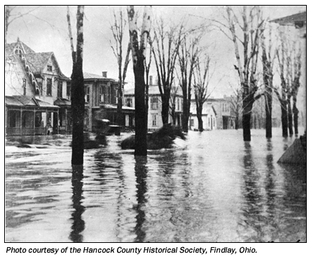
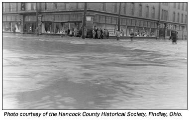
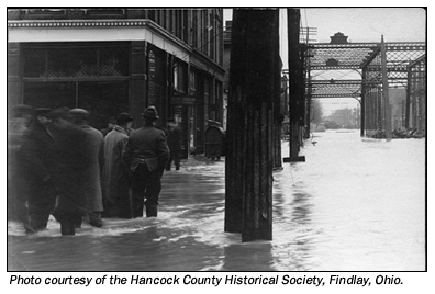
The worst flood of maximum record occurred in 1913 and completely inundated the business districts adjacent to the City of Findlay for several days. The Blanchard River discharge for this flood was estimated to be 22,000 cubic feet per second (cfs), well in excess of a 500-year flood, with the river cresting at 18.5 feet. The low areas along both sides of the Blanchard River upstream and downstream of the city are the first to be subjected to flooding when the river stage reaches approximately 12 feet at the USGS gaging station (No. 4189000) downstream of the City of Findlay. The rise and fall of flood crests on the Blanchard River usually extend over a period of two to three days. This period is increased to four or five days during extremely severe floods.
Impacts
The Blanchard River, a branch of the Auglaize River, flooded an estimated 60% of the City of Findlay, driving 3,000 from their homes. According to a local newspaper at the time, the only loss of life was Police Captain Albert McGown, who was rescuing a marooned family when he was swept away by the whirling waters. Another newspaper article estimated the damages ranged from $80,000-$100,000.
Flood Protection Measures
Levees exist in the study area that provide the community with some degree of protection against flooding. However, it has been ascertained that some of these levees may not protect the community from rare events such as the 100-year* flood. The county regulates the use of floodplains through local building codes and zoning ordinances.
* 100-year flood is old terminology. Agencies are now using the term "1% Flood Level" which is the maximum flood level with a one-percent chance of occurring within any given year.