The Great Flood of 1913
100 Years Later

Community Profiles: Chillicothe, Ohio
| River: | Scioto |
| Storm Total Rainfall: | 6.90" |
| Known Fatalities: | 18 |
Timeline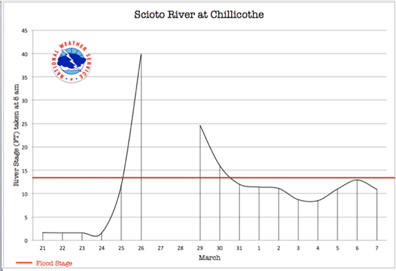
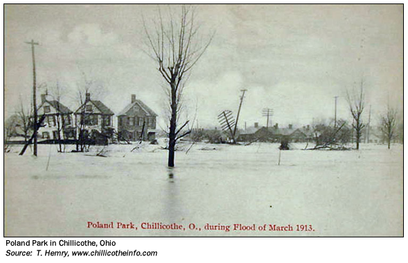
Once the flood waters flushed downstream and out of Columbus, it produced little damage until it reached Chillicothe. The flood waters in Chillicothe in 1913 were 8 feet higher than ever before. The confluence of the Paint Creek and the Scioto River occurs at Chillicothe. The town itself is built on a low terrain that slopes from the Scioto to the Paint Creek. The water was at 11.9 feet on Tuesday, and had risen so slowly during the day that the observer did not even bother looking at the gage that evening as he left work. By 2 a.m. on Wednesday morning the river had risen to 18 feet. A levee failed around 5:15 a.m. on the Scioto, and the city was becoming inundated. By 6 a.m. the river was at 35 feet. It crested that morning at 11 a.m. near 40 feet, with 70% of the city flooded.
Impacts
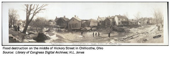
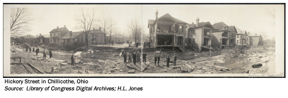
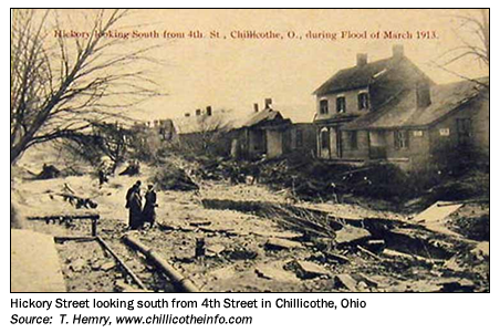
The worst damage and the highest number of casualties occurred in a residential section in the eastern part of town. For a town with a population of around 15,000, it saw 200 houses destroyed and over 500 were homeless. This panorama shows the destruction of houses on Hickory Street, where the worst damage in Chillicothe occurred. Eighteen people were reported dead, with many more missing and thousands left homeless. The flood waters carved out a channel 6 to 10 feet deep on Hickory Street. The business district was also severely flooded and property damage was high. The 1959 flood, which was much less damaging than the 1913 flood, caused an estimated $2,800,000 worth of damages to the City.
Flood Protection Measures
Flooding in the Scioto River valley has been severe, with much of the City of Chillicothe inundated, as a result of major storms in March 1913, January 1937, and January 1959. A series of levees have been built along the south bank of the Scioto River and are certified to provide protection for Chillicothe from flood stage equal to that caused by the 1913 flood, which had a recurrence interval of 350 years (0.3- percent-annual-chance flood). All of these measures will reduce the severity of flooding from major storms.