The Great Flood of 1913
100 Years Later

Community Profiles: Attica, Indiana
| River: | Wabash |
| Storm Total Rainfall: | 8.24" |
| Known Fatalities: |
Timeline
From “Flood on the Wabash River in March 1913” by W.R. Cade, U.S. Weather Bureau Observer.
Early Sunday, March 23 the Wabash River at Attica was at a normal level for March with a river stage of 6.8 feet and falling. A heavy rain fell on March 23 over the entire district and by Monday morning amounts ranged from one inch at Terre Haute to nearly four inches at Bluffton. This heavy rain caused the river to rise at a record-breaking rate with flooding in progress at Attica.
The heavy rain continued Monday, and the amounts on Tuesday morning were equally as large as those the previous morning and ranged from two to three inches. The river continued to rise very rapidly. The river was approaching the record level of the August 1875 flood.
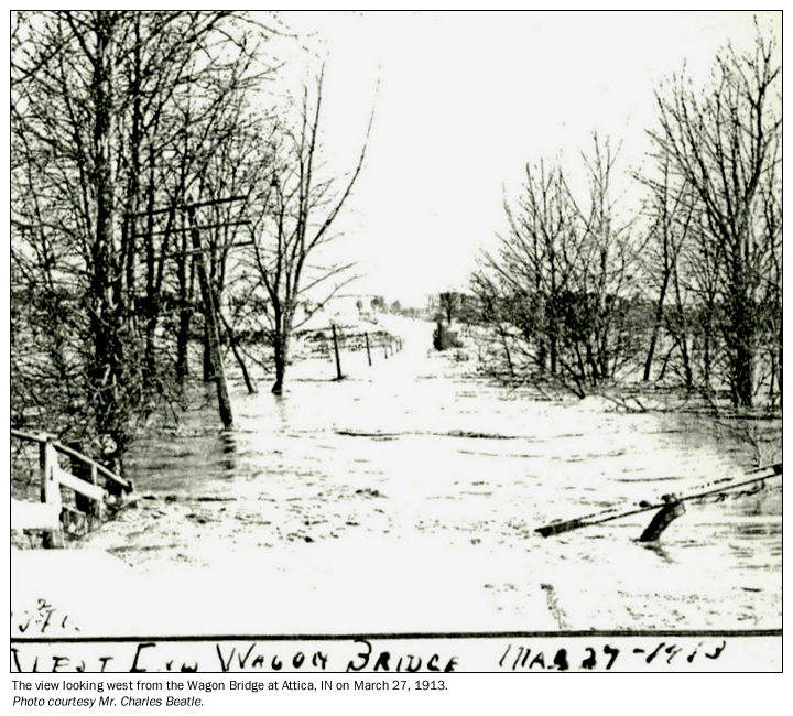
A break in the rainfall occurred during the day on Tuesday because only slight amounts of rain were reported on Wednesday, March 26, but the river continued rising. The Wabash River had surpassed the August 1875 flood level, and was at a record level at Attica by Wednesday morning and nearing crest. About half of an inch of rain fell over the valley during the 24 hours ending March 27. Attica crested at 33.4 feet on the 27th.
Impacts
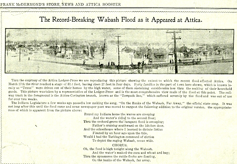
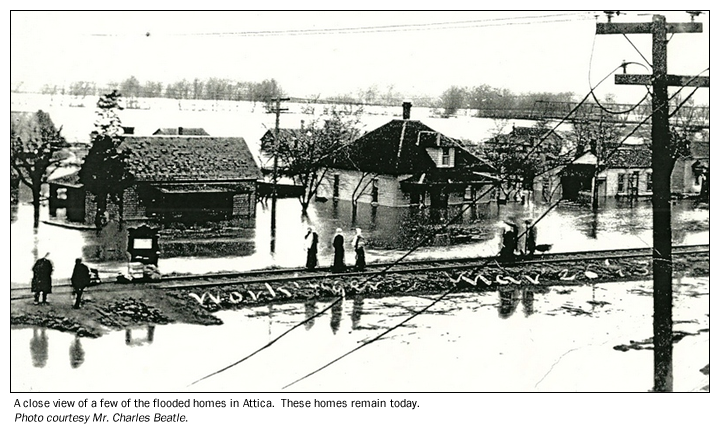
Over 200 residents and over 40 residences were flooded in Attica west of what was then call “The Towpath Line”. Residential flooding was severe as flood water rose rapidly and residents had little time to move belongings. The flooded area was locally known as Texas. Flooding destroyed or heavily damaged most railroad, highway and wagon bridges in Attica, Covington and Lafayette, and washed out extensive stretches of railroad ballast. The newspaper picture below describes the graphic detail of the flooding:
Flood Protection Measures
River Gauge readings ended at Attica on September 30, 1913. Today, Attica residents use the Covington river gauge to monitor flooding along the Wabash.
Three Corps of Engineers flood control reservoirs upstream of Attica (JE Roush, Salamonie and Mississinewa), provide some flood control benefits at Attica, but a March 1913 flood level would still be possible. There are local levees in the area.
To add information about the March 1913 flooding at Attica, e-mail Al Shipe at al.shipe@noaa.gov.