May 22-31, 2019
Midwest Weekly Highlights - May 22-31, 2019
Warmer for Many
Temperatures were above normal across a large portion of the southern and central Midwest during the period
(Figure 1). The warmest areas were in Kentucky and the Ohio River Valley, were temperatures were 7-9°F above normal. Most of Missouri and Illinois were also 3-6°F above normal. Eastern Iowa, southern Wisconsin and southern Lower Michigan were 1-3°F above normal. More than 150 daily temperature records were broken, with more than 100 coming from high minimum temperatures (Figure 2). Minnesota and northwestern Iowa were the only areas a few degrees below normal.
Heavy rain in Iowa, Missouri and Illinois
Very wet conditions were observed across Iowa, Missouri and Illinois during the period
(Figure 3). Amounts of over 3 inches were common across these areas, with amounts of over 6 inches in far southern Iowa and northern Missouri. Rainfall in these areas translated to 3-5 times the normal amount (Figure 4). A pattern of storms over these same areas led to heavy rainfall on multiple days, with the heaviest amounts through the mornings of May 24
(Figure 5), May 26 (Figure 6) and May 29
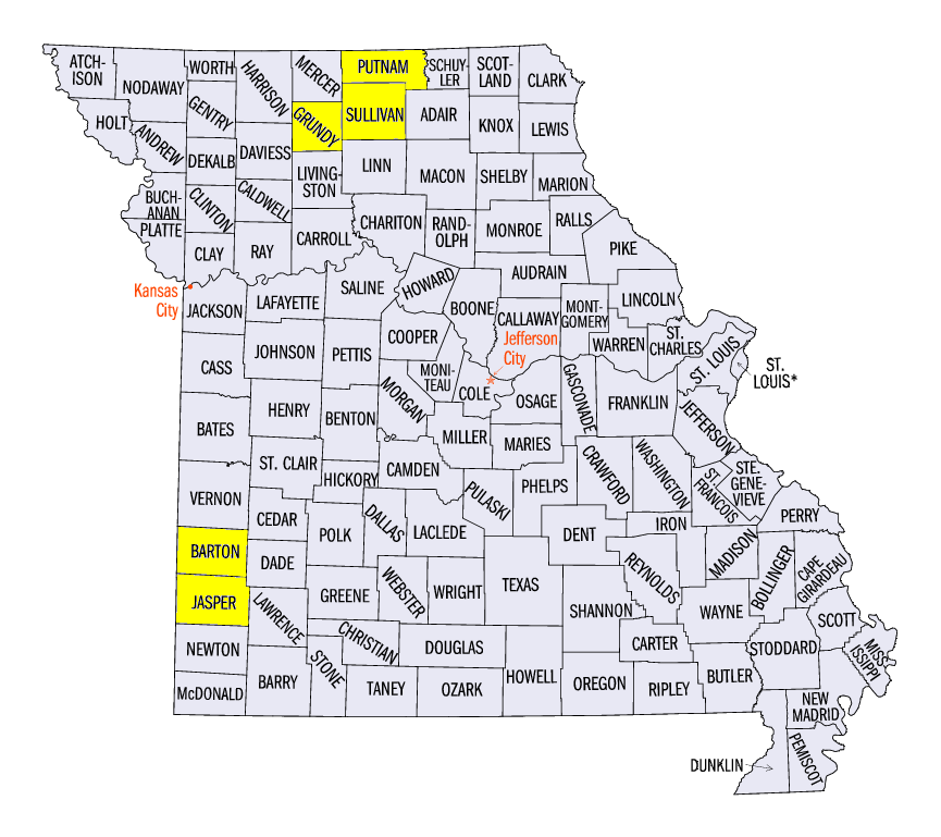
(Figure 7). In Missouri, some of the heaviest amounts for the period included 17.20 inches in Milan (Sullivan County), 11.93 inches near Spickard (Grundy County) and 10.68 inches in Unionville (Putnam County). In Iowa, amounts included 7.93 inches in Shenandoah, IA (Page County) and 7.89 inches in Massena (Cass County). More than 240 daily precipitation records were broken in the region from the heavy rainfall (Figure 8).
Strong Winds and Hail
Severe weather reached a new high for 2019 during the final 10 days of May, with reports of damaging winds and hail on each day during the period
(Figure 9). More than 600 wind reports and nearly 200 hail reports led to damage across Iowa, Missouri, Illinois, Indiana and Ohio. A majority of the strong winds and hail occurred on May 22 (Figure 10) and May 25
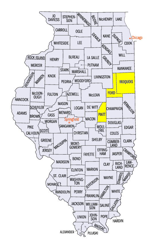
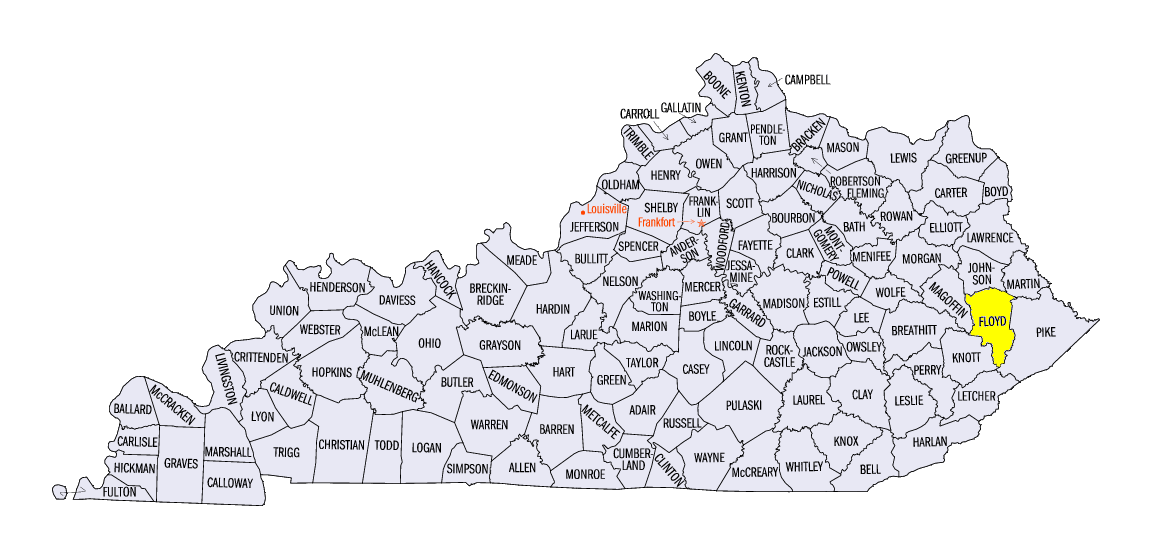
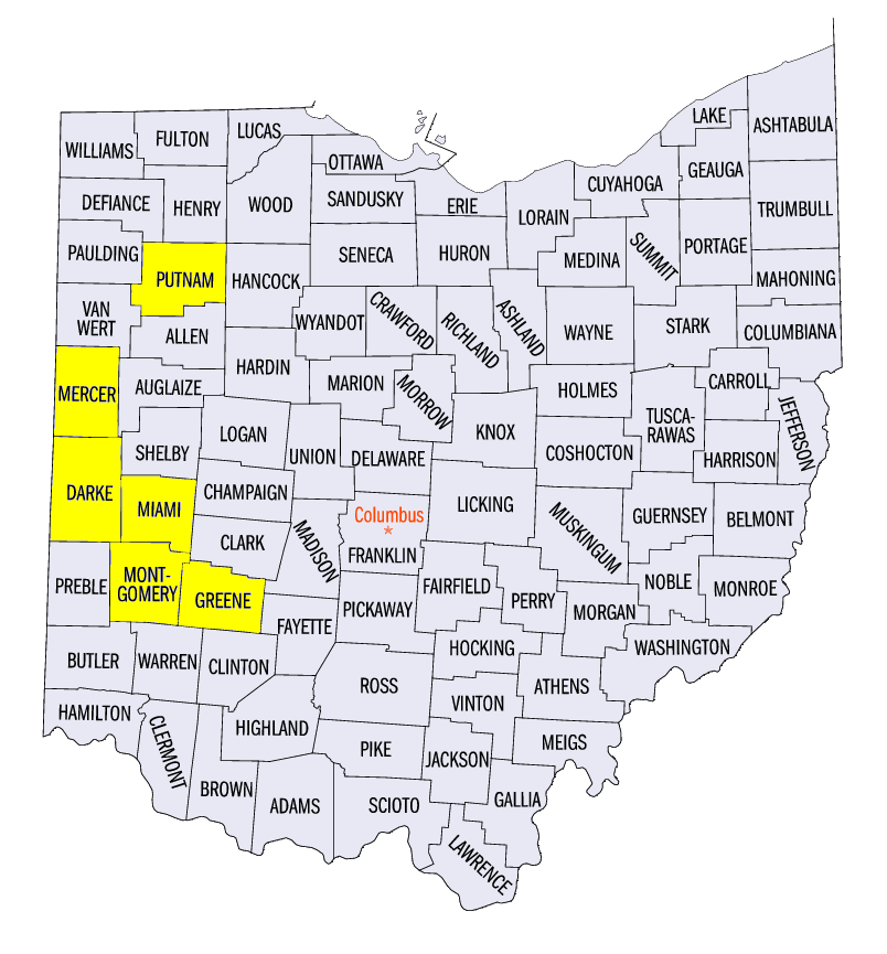
(Figure 11). Wind reports during the period included an 80 mph gust near Sibley, IL (Ford County) on May 22, an 83 mph gust near Watseka, IL (Iroquois County) on May 22 and an 80 mph gust near Prestonburg, KY (Floyd County) on May 29. The latter gust was caused by a downburst that led to a fatality when a roof from a building was blown off and onto a vehicle. Hail reports included diameters of 2.5 inches near Deland, IL (Piatt County) on May 28, 3.0 inches near Kieferville, OH (Putnam County) on May 28 and 4.0 inches near Pine Village, IN (Tippecanoe County).
May 22 Southwest Missouri Tornadoes
Several destructive tornadoes impacted southwestern Missouri on May 22, including two EF-3 tornadoes (Figure 12). The first of these EF-3 tornadoes went northwest of Joplin through Carl Junction, MO (Jasper County). Peak winds of 140 mph were estimated as trees were uprooted and well-built multi-story homes were significantly damaged along the nine-mile path. Fortunately, no injuries or deaths were reported. The other EF-3 tornado impacted Golden City, MO (Barton County). Peak winds were estimated at 142 mph with a path of 12 miles and a maximum width of a half mile. Three fatalities were reported from people in their homes, along with another injury. Four other tornadoes were reported in Missouri during the evening and overnight hours. Minor to moderate riverine flooding was also reported along with flash flooding from several inches of rainfall from May 20-22.
May 27-28 Tornado Outbreak
Powerful and destructive tornadoes affected parts of Iowa, Illinois, Indiana and Ohio on May 27-28 (Figure 13). Several dozen tornadoes were confirmed across the region, with three EF-3 and one EF-4 tornado in Ohio around 10-11pm local time. The strongest tornado occurred in Montgomery County, OH, packing EF-4 winds estimated at 170 mph. The storm tracked 19 miles from Brookville, to Trotwood, Dayton and Riverside for 31 minutes, with a maximum width of over half a mile. Hundreds of homes and apartment complexes were damaged along with thousands of trees. The three EF-3 tornadoes confirmed in Ohio occurred near West Milton, OH (Darke/Miami counties), near Celina, OH (Mercer County) and from eastern Montgomery into western Greene County, OH. A fatality was reported in Celina when an automobile became airborne and hit a home. An injury was also reported from the West Milton tornado as a trailer home flipped, leading to broken ribs from an occupant.
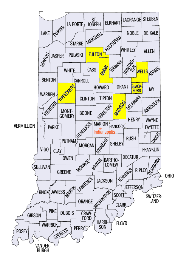
Earlier in the evening in Indiana, several more damaging tornadoes moved across the northern half of the state. An EF 3 tornado was reported near Macy (Miami and Fulton counties) with a maximum path width of a half mile and winds up to 140 mph. Two injuries at a dairy farm were reported near Roll, IN (Blackford and Wells counties) from an EF-3 tornado with 150 mph winds and a path nearly seven-tenths of a mile wide. Another tornado near Pendleton, IN (Madison County) also led to a non-life threatening injury.
Flood Waters Rise Again
Increased precipitation during the final 10 days of May kept rivers from receding once again (Figure 14). Major flooding occurred along the Mississippi River
(Figure 15) along most of the western Illinois border by the end of the period as heavy rain continued to fall. Major flooding was also reported along the Missouri River (Figure 16), Illinois River
(Figure 17), Kaskaskia River (Figure 18), South Sauk River
(Figure 19) and Grand River (Figure 20).
-BJP-