May 15-21, 2019
Midwest Weekly Highlights - May 15-21, 2019
Divided Temperatures
A north/south divide in temperatures was observed across the Midwest during the week, with warmer than normal temperatures to the south and colder than normal to the north
(Figure 1). Most of Minnesota, Wisconsin and the U.P. of Michigan were 3-6°F below normal. Missouri, southern Illinois, southern Indiana, Ohio and Kentucky were all 2-4°F above normal. The divide in temperatures led to records on both ends of the spectrum, with more than 100 daily low records (Figure 2) and more than 75 daily high records
(Figure 3).
Wet Along the West
Moderate to heavy precipitation across the western half of the region led to another wet week for the region (Figure 4). Amounts of over an inch were common, with areas in southwestern Missouri and southeastern Iowa receiving more than 3 inches. This translated to 2-3 times the normal amount (Figure 5). Areas in northern Wisconsin and the U.P. of Michigan also had more than three times the normal amount. More than 100 daily precipitation records were broken across the region as a result (Figure 6).
Despite the wetter conditions for many, the record streak of 12 consecutive weeks with no drought or abnormally dry conditions in the U.S. Drought Monitor for the Midwest ended on May 21
(Figure 7). Areas prone to abnormal dryness in northern Minnesota were the first areas to be abnormally dry in the region since February 19. Drought-free conditions continued, however, extending the region’s drought-free year.
Slow Planting Season Continues
Wetter weather once again kept planting from accelerating across the region according to the NASS Crop Progress Report for May 19. Corn planting remained well behind across the region, with Illinois, Indiana and Ohio all more than 50 percent behind the five-year average (Figure 8). Illinois was the most behind at 65 percent. Wisconsin, Michigan and Missouri were also at least 30 percent behind the five-year average. Nationally, only 49 percent of the corn crop was planted, compared to the five-year average of 80 percent. Soybeans were significantly behind as well across the region
(Figure 9). Every state except Kentucky was at least 20 percent behind the five-year average, with Minnesota, Illinois, Indiana and Ohio more than 30 percent behind. Illinois was the worst state again at 42 percent behind the five-year average.
Severe Weather Ramps Up
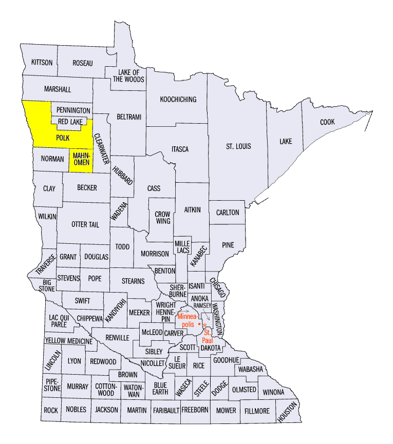
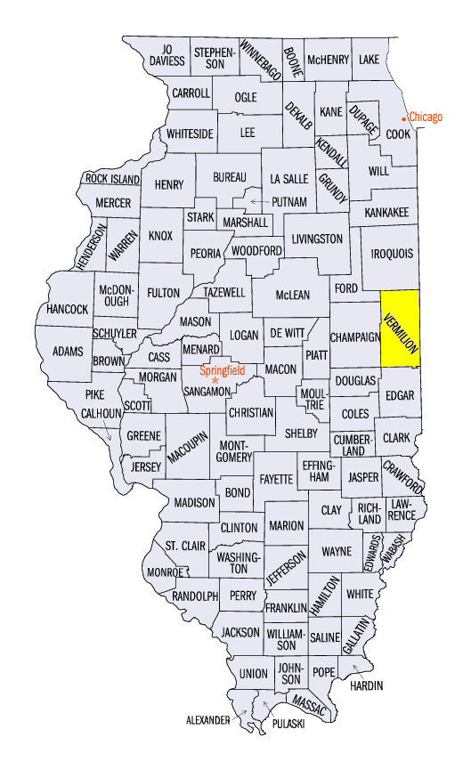
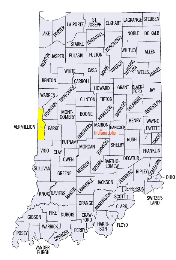
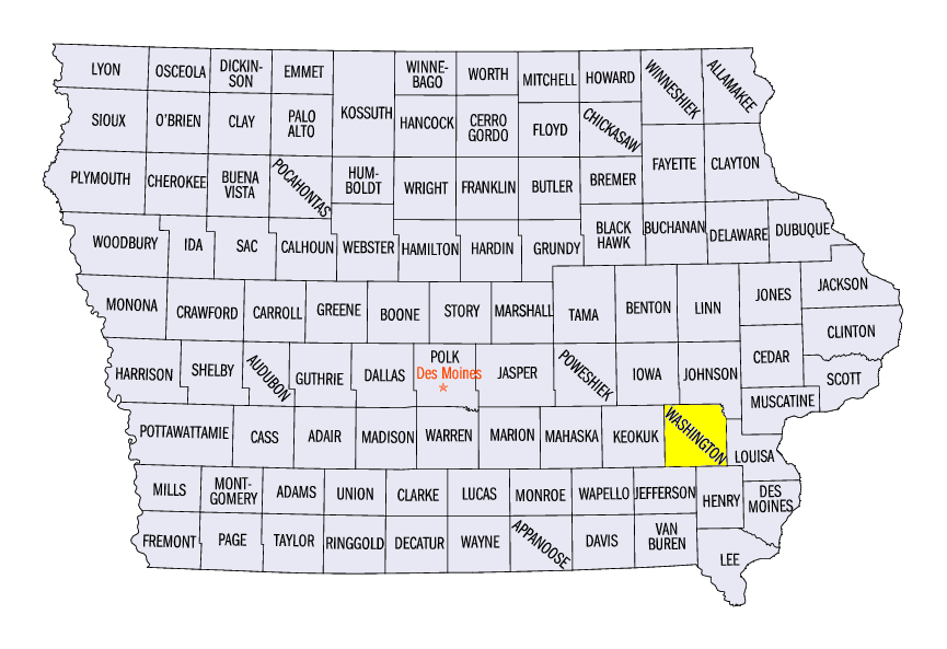
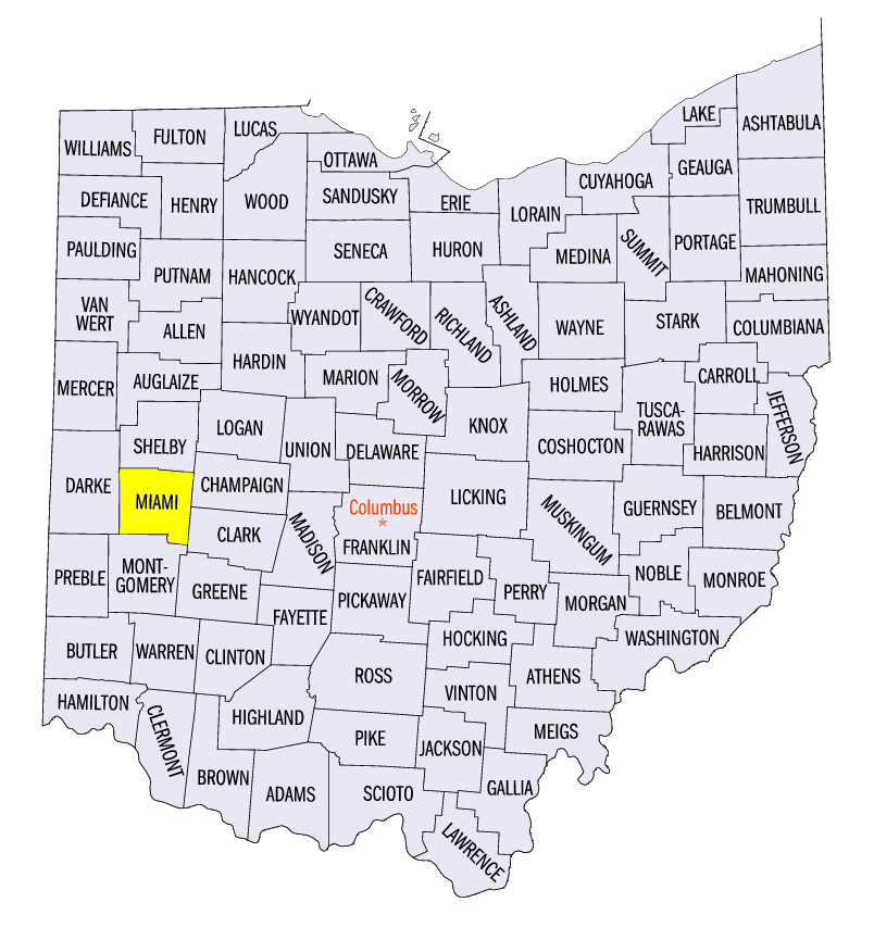
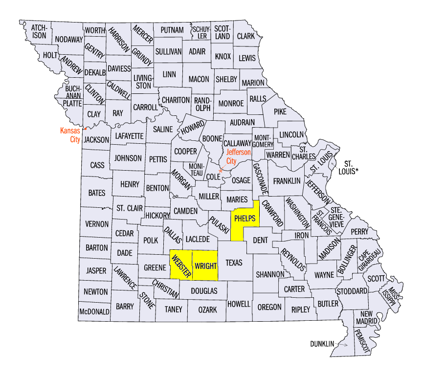
After a fairly quiet start to 2019 in the Midwest, severe weather ramped up across the region during the week (Figure 10). Strong winds, hail or tornadoes were reported on each day during the period in the region. Strong winds began the week in northern Minnesota on May 15, where 90 mph winds were estimated near East Grand Forks, MN (Polk County) and near Waubun, MN (Mahnomen County). Strong winds and large hail affected parts of Iowa, Illinois and Indiana on May 16. Large hail from 2.5 to 2.75 inches fell in the bordering Vermillion counties of Illinois and Indiana. Strong winds were also reported in Iowa, with an 86 mph gust near River Junction, IA (Washington County). Two people were also injured near Tipp City, OH (Miami County) from a tree falling onto a house. Scattered strong winds and hail were observed on May 17-18 before several small tornadoes were observed on May 19. An EF-1 tornado was confirmed near Huber Heights, OH (Montgomery County). Strong winds and tornadoes affected Missouri on May 20-21. Trees were toppled by the strong winds and several EF-1 tornadoes were reported in Webster, Wright and Phelps counties.
Flooding Remains
Minor to major flooding remained along the Mississippi River and its tributaries during the week
(Figure 11). While some areas briefly receded, a large portion of the Mississippi River along the Illinois Border was in moderate or major flood stage (Figure 12). Major flooding along the Illinois River also continued
(Figure 13).
-BJP-