May 22-31, 2026
Temperature
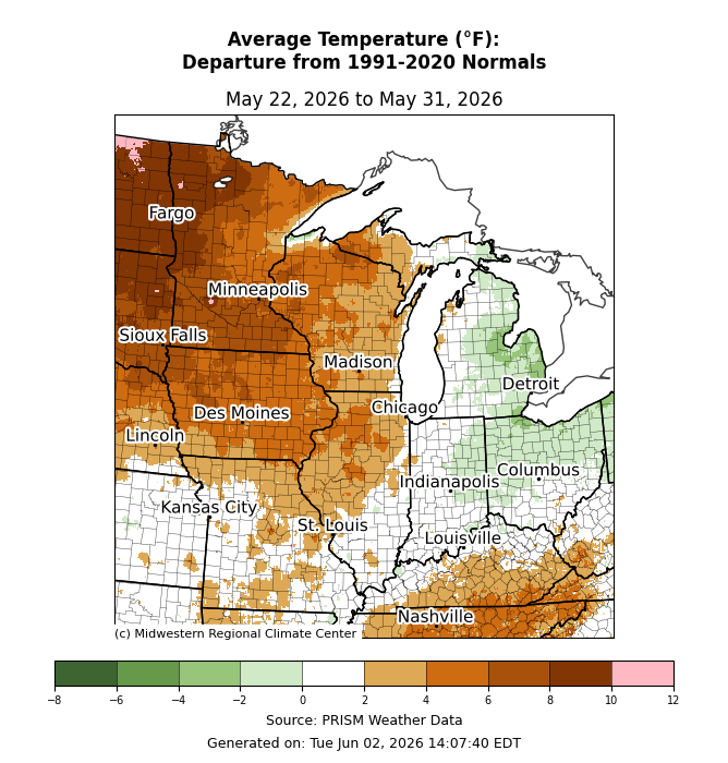
Average temperatures across the northwest quadrant of the region were as much as 8-10°F above normal. Eastern areas, such as eastern Michigan and Ohio, were slightly below normal for the week (Figure 1). Average temperatures were near normal along I-65 from Chicago before climbing slightly above normal in southern Kentucky.
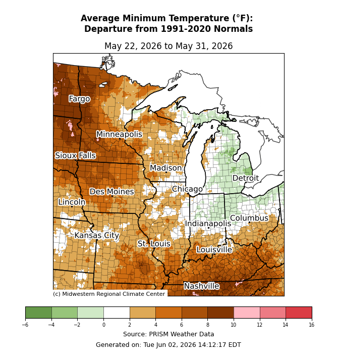
Minimum temperatures averaged above normal for much of the region (Figure 2). Across western Minnesota, minimum temperatures were up to 10°F above normal. Meanwhile, across eastern Indiana, eastern Michigan, and northern Ohio, temperatures were slightly below normal.
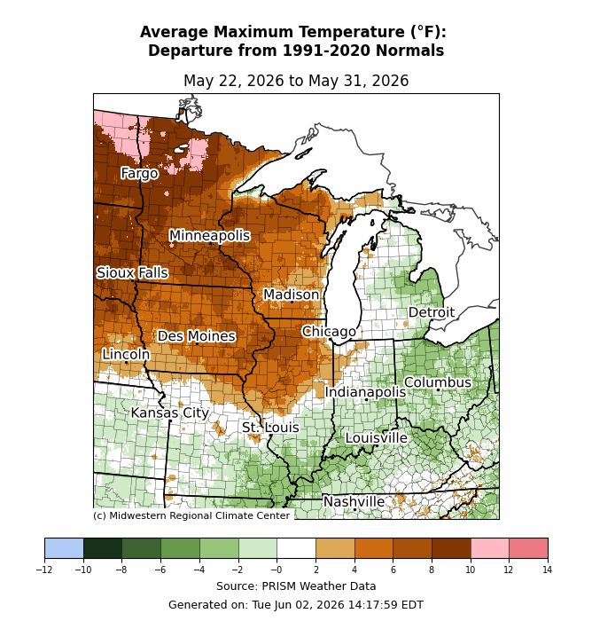
Maximum temperatures were above normal across northern Illinois, Iowa, Michigan’s Upper Peninsula, Minnesota, and Wisconsin (Figure 3). Across northern Minnesota, maximum temperatures were up to 12°F above normal. Across eastern and southern parts of the region, maximum temperatures were below normal, generally by 2-4°F.
Precipitation/Drought
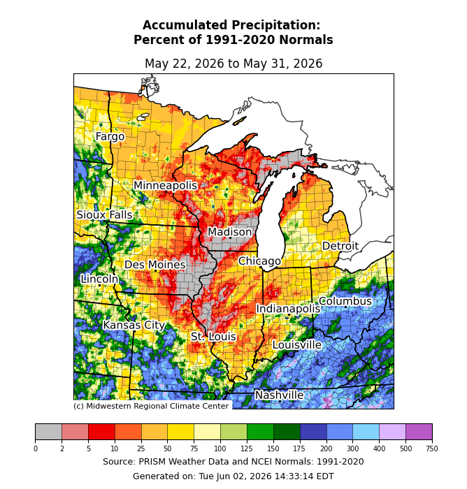
Precipitation was below normal for much of the region, with no observed precipitation across southern Wisconsin and eastern Iowa (Figure 4). The Upper Midwest observed precipitation at 10-50 percent of normal. Across Kentucky, southern Missouri, and southern Ohio, observed precipitation exceeded 200 percent of normal in some areas.
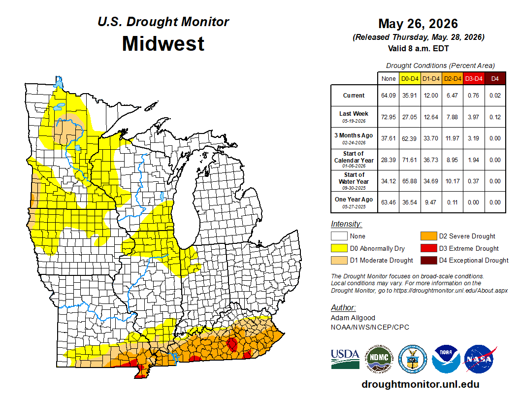
Precipitation alleviated drought concerns across southern parts of the region. As of May 26, only 5 percent of Kentucky remained under D3 (extreme drought), a significant improvement from May 19, when 41 percent of the state was under D3 conditions. Still, over 80 percent of the state was under at least D1 (moderate drought) as of May 26. There was also improvement of D3 conditions across the Missouri Bootheel. Elsewhere, D0 (abnormally dry) conditions expanded, particularly across the Upper Midwest (Figure 5).
Storm Reports
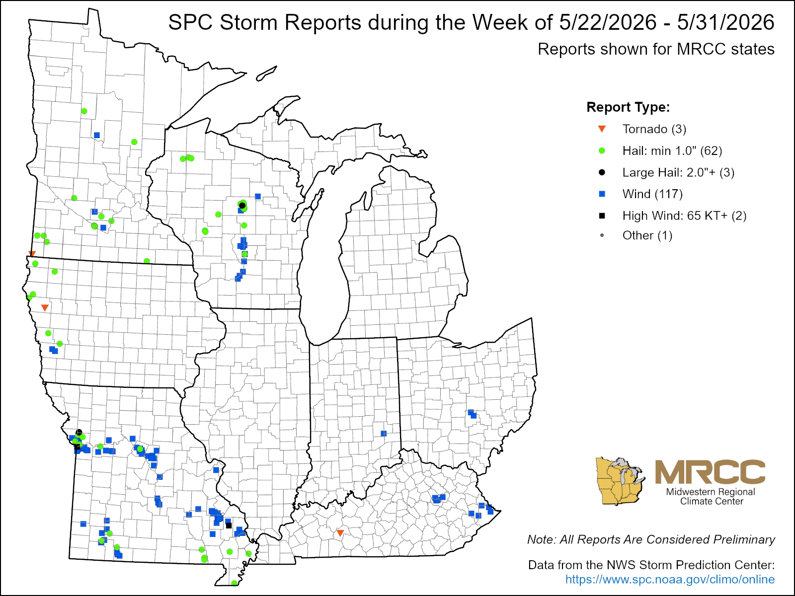
There were almost 200 storm reports this week, with 117 wind reports and 62 hail reports (Figure 6). There were 3 tornado reports, including one confirmed EF0 tornado in Butler County, Kentucky, with peak winds of 85 mph. Later in the period, a severe weather event on May 31 brought hen-egg-sized hail to Clinton County, Missouri. Straight-line wind gusts on May 31 rose to 82 mph at Kansas City Downtown Airport.